Slope Stability Monitoring: How InSAR Satellites Detect Pit Wall Failures Before They Happen
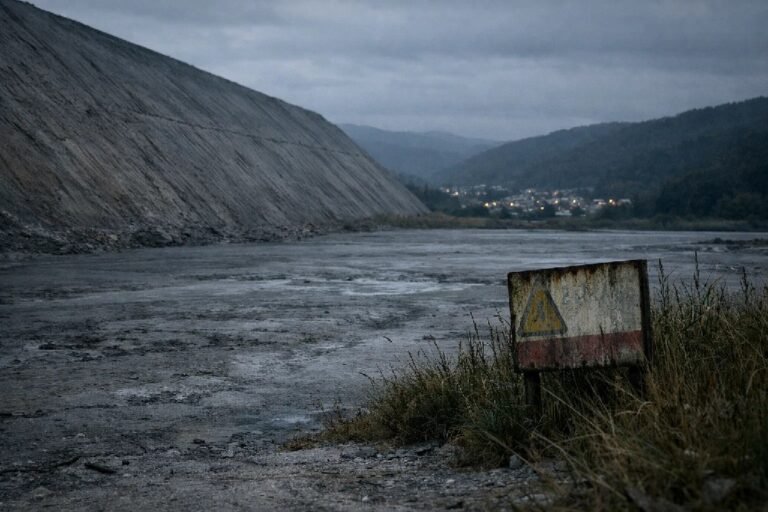
On February 22, 2023, the Xinjing Coal Mine in Inner Mongolia collapsed without warning. Fifty-three miners lost their lives. Economic losses exceeded $28.7 million. The subsequent investigation revealed what satellite deformation monitoring could have detected months earlier: progressive ground displacement accelerating toward catastrophic failure.
Compare this tragedy with Bingham Canyon Mine in Utah, 2013. The largest slope failure in mining history sent 144 million tons of rock cascading into the pit. Yet not a single person was injured. The difference was not luck — it was months of continuous slope stability monitoring that detected accelerating movement and enabled complete evacuation before the collapse.
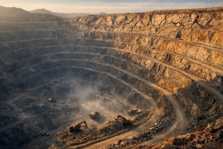
As open-pit mines worldwide push deeper to access declining ore grades, slope angles become steeper, and the physics of failure become more unforgiving. Traditional monitoring approaches — periodic surveyor visits, visual inspections, scattered prism networks — cannot provide the continuous, wide-area surveillance that modern mining operations demand. The emergence of InSAR mining technology has fundamentally changed this equation, enabling millimeter-scale displacement detection across entire mine sites without installing a single sensor on unstable ground.
This comprehensive guide examines how satellite and ground-based technologies work together to prevent slope disasters, the economics of implementation, and the critical lessons learned from both successful interventions and tragic failures in 2024 and 2025.
The Critical Importance of Slope Stability Monitoring in Open-Pit Mining
Understanding Slope Failure Modes in Mining Operations
Slope failures in open-pit mines follow predictable mechanical patterns, though the timing of final collapse remains challenging to pinpoint without continuous monitoring. Geotechnical monitoring programs must account for four primary failure modes, each with distinct precursor signatures detectable through satellite deformation monitoring.
Planar failures occur when a weak geological plane — a bedding surface, fault, or joint set — daylights into the pit wall at an angle steeper than the friction angle of the discontinuity. These failures typically develop gradually, with millimeter-scale displacement detectable weeks or months before sudden acceleration. Wedge failures form when two intersecting discontinuities create a removable block, often releasing suddenly when groundwater pressure reduces effective stress. Circular failures develop in weak, homogeneous materials like deeply weathered rock or poorly consolidated overburden, creating the characteristic curved failure surface. Toppling failures occur when steeply dipping columns of rock rotate forward under gravity, progressively destabilizing the slope from the crest downward.
Each failure mode generates characteristic deformation patterns that InSAR mining technology can detect. The critical insight for pit wall stability management is that all major failures pass through identifiable deformation phases before catastrophic release — phases that satellite monitoring can capture across the entire mine footprint simultaneously.
The Economic and Human Cost of Undetected Slope Failures
The statistical reality of open pit slope failure risk is sobering. Data from the Mine Safety and Health Administration reveals that between 2000 and 2021, United States mining operations recorded 27,520 ground control accidents resulting in 122 fatal events and more than 8,800 injuries. The Centers for Disease Control calculates the median cost per mining fatality at $1.42 million when accounting for direct costs, lost productivity, and regulatory consequences.
International data reinforces these findings. A comprehensive study of slope failures in Indian open-pit mines documented 23 catastrophic events between 1901 and 2016, resulting in 143 deaths. The 2023 Xinjing disaster in China, with 53 fatalities and $28.7 million in direct economic losses, demonstrates that even modern operations remain vulnerable when monitoring systems fail to provide adequate warning.
Beyond the human toll, undetected slope failures create cascading operational consequences. Production halts while debris is cleared and stability is reassessed. Equipment buried in slide debris may be unrecoverable. Regulatory scrutiny intensifies, potentially affecting permits and expansion plans. Insurance premiums escalate. Most significantly, the loss of institutional knowledge and workforce confidence can take years to rebuild.
The Bingham Canyon contrast illuminates the alternative path. Rio Tinto’s monitoring program detected progressive acceleration across the northeast wall months before the April 2013 failure. Systematic evacuation protocols removed all personnel and mobile equipment from the affected zone. When 144 million tons finally released, the only losses were fixed infrastructure that could not be relocated. The monitoring investment paid for itself thousands of times over in a single event.
How InSAR Technology Enables Millimeter-Scale Slope Stability Monitoring
The Physics of Differential Interferometry for Deformation Detection
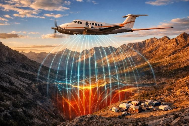
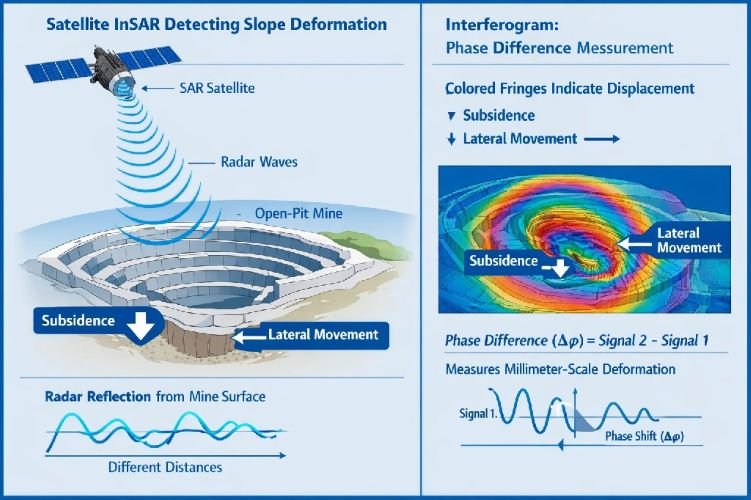
Interferometric Synthetic Aperture Radar represents one of the most significant advances in geotechnical monitoring of the past three decades. The technology exploits a fundamental property of radar waves: their phase encodes precise distance information. When a satellite passes over the same location multiple times, comparing the phase of returned signals reveals changes in the distance between satellite and ground — changes measured in millimeters.
The process begins when SAR satellites like Sentinel-1, TerraSAR-X, or COSMO-SkyMed transmit microwave pulses toward Earth. These pulses reflect from the ground surface and return to the satellite, where sensitive receivers measure both the amplitude and phase of the returned signal. A single SAR image encodes phase information for millions of individual ground pixels.
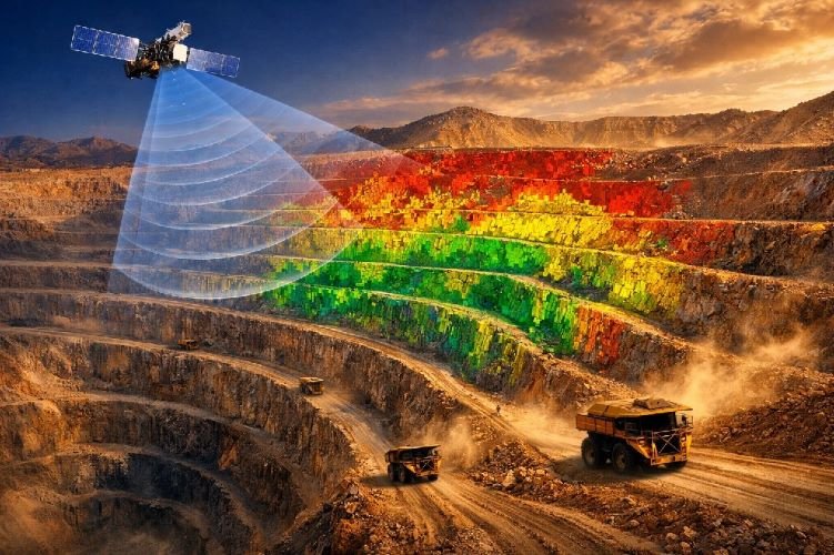
DInSAR open pit applications compare two or more SAR images acquired from nearly identical orbital positions at different times. The phase difference between images, after correcting for known factors like satellite geometry and atmospheric effects, reveals ground displacement along the satellite’s line of sight. Modern processing achieves precision of 1-3 millimeters over areas spanning hundreds of square kilometers — a capability impossible to replicate with any ground-based survey network.
Sentinel-1 satellites, operated by the European Space Agency, provide free data with revisit times of 6-12 days depending on location. Commercial satellites like TerraSAR-X offer higher resolution (down to 1 meter) with 11-day repeat cycles. This satellite deformation monitoring operates regardless of weather conditions, cloud cover, darkness, or site accessibility — radar penetrates clouds, smoke, and dust that would blind optical systems.
PS-InSAR and SBAS-InSAR Processing Techniques for Mining
Raw interferometric measurements contain noise from atmospheric water vapor, orbital errors, and surface change unrelated to deformation. Advanced processing techniques extract reliable displacement signals from this complexity.
Persistent Scatterer Interferometry (PS-InSAR) identifies ground features that maintain consistent radar reflectivity across many satellite passes. In mining environments, these persistent scatterers include rock outcrops, infrastructure, equipment, and stable bench surfaces. By tracking phase changes at these reliable points over time series spanning months or years, PS-InSAR reconstructs detailed displacement histories with sub-millimeter precision.
Small Baseline Subset (SBAS-InSAR) takes a different approach, analyzing interferograms with short temporal and spatial baselines to maintain coherence in areas where persistent scatterers are sparse. This technique proves valuable for monitoring waste dumps, tailings surfaces, and recently excavated areas where surface conditions change rapidly.
The density of measurement points achievable in mining environments is remarkable. Studies document up to 10,000 measurement points per square kilometer in areas with favorable radar characteristics. This density far exceeds what any practical ground-based monitoring network could achieve, enabling detection of localized anomalies that might indicate developing instability.
Detecting Failure Precursors Months Before Catastrophic Events
The transformative value of slope stability monitoring through satellite InSAR lies in its ability to detect the early stages of slope instability — often months before visual signs appear or ground-based instruments are triggered. This capability has been validated through both successful interventions and tragic retroanalyses of disasters that better monitoring might have prevented.
A landmark study published in 2018 examined an undisclosed copper open-pit mine where an unexpected slope failure occurred on November 17, 2016. Satellite InSAR data acquired retrospectively revealed that accelerating creep was detectable across the failure zone for nine months before the collapse. The ground-based radar system operating at the time detected movement only on the upper two benches visible from its position — while satellite data showed the majority of the instability involved natural slope above the mine crest, entirely outside the ground radar’s field of view.
The Brumadinho tailings dam disaster of January 2019, which killed 270 people in Brazil, has been subjected to extensive retroanalysis. Independent researchers demonstrated that satellite deformation monitoring could have detected precursory signals at least five months before the catastrophic liquefaction failure. The dam exhibited progressive movement patterns that, with the benefit of continuous satellite surveillance, would have raised alarms long before the sudden collapse.
These cases establish a crucial principle for slope failure prediction: the warning signs are almost always present in the deformation data. The challenge lies in acquiring that data with sufficient frequency, coverage, and precision — capabilities that satellite InSAR delivers more comprehensively than any alternative technology.
Protect Your Mining Operations with Satellite Slope Monitoring
SkyIntelGroup delivers millimeter-precision InSAR monitoring for open-pit mines worldwide. Detect slope instabilities months before they become critical — without installing equipment on unstable ground.
Ground-Based Radar vs. Satellite InSAR: Why Mining Operations Need Both
Slope Stability Radar for Real-Time Tactical Monitoring
While satellite InSAR excels at wide-area surveillance and long-term trend detection, ground-based radar mining systems provide the real-time alerting capability essential for protecting workers in active mining zones. Understanding the complementary strengths of both technologies is fundamental to designing effective slope stability monitoring programs.
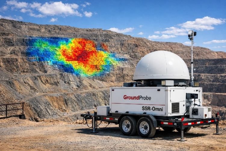
Slope stability radar systems like GroundProbe’s SSR-XT, SSR-Omni, and SSR-FX, or IDS GeoRadar’s IBIS platform, operate on the same interferometric principles as satellite InSAR but from fixed positions near the pit. These systems scan their field of view every 2 to 40 minutes, depending on configuration, achieving sub-millimeter measurement precision at ranges up to 5.6 kilometers.
The SSR-Omni system provides 360-degree coverage from a single installation, scanning the entire visible pit perimeter continuously. This high temporal resolution enables detection of acceleration phases that develop over hours rather than days — the critical window for implementing Trigger Action Response Plans and executing evacuations.
Ground-based systems generate immediate alerts when displacement rates exceed configured thresholds. Modern platforms integrate with mine control systems to trigger automatic notifications to supervisors, halt blasting operations, and initiate evacuation protocols. This real-time response capability has prevented numerous casualties in documented near-miss events.
Why Satellite InSAR Reveals What Ground Radar Cannot See
The 2016 copper mine failure case study illustrates a critical limitation of ground-based radar that satellite monitoring overcomes. The mine’s slope stability radar system detected progressive movement on the upper benches within its field of view. Geotechnical staff monitored these readings and assessed the risk as manageable.
What the ground radar could not see — and what satellite deformation monitoring later revealed — was that the majority of the developing instability involved natural slope above the mine crest. This area sat behind the radar’s line of sight, invisible to ground-based instruments. When failure finally occurred, the scale exceeded expectations precisely because the actual failure mass was far larger than the monitored zone suggested.
Satellite InSAR suffers no such geometric constraints. Orbital platforms view the entire mine footprint plus surrounding natural slopes, infrastructure corridors, access roads, and downstream areas of potential impact. Historical archives extending back to 1992 for some sensors enable baseline establishment and trend analysis for properties acquired or permitted years ago.
The strategic implication is clear: ground-based radar mining systems protect workers in real-time within their coverage zones, while satellite InSAR provides the contextual awareness to ensure those coverage zones are correctly positioned and that hazards outside them are not overlooked.
Integrating Multiple Monitoring Technologies
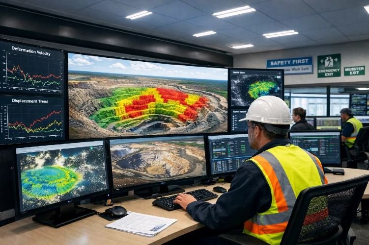
Best-practice geotechnical monitoring programs deploy multiple technologies in a layered approach, each contributing unique capabilities to the overall surveillance picture. A typical deployment for a large open-pit operation in 2026 combines satellite InSAR for site-wide baseline and trend monitoring with ground-based radar positioned at active working faces and zones identified as elevated risk through InSAR analysis.
Robotic total stations with automated prism tracking provide independent verification of displacement measurements at critical benchmarks. Piezometers monitor groundwater pressure in slopes where hydrogeological conditions influence stability. Inclinometers track subsurface deformation at depths beyond the reach of surface-based methods. GPS receivers on critical infrastructure enable precise positioning that validates satellite observations.
Data fusion platforms integrate feeds from all these sources into unified visualization environments. GroundProbe’s MonitorIQ, Viridien’s SatExplorer, and various custom GIS integrations enable geotechnical engineers to correlate observations across technologies, identify discrepancies requiring investigation, and develop comprehensive situational awareness that no single data source could provide.
The Inverse Velocity Method: Predicting Exactly When Slopes Will Fail
Understanding the Three Phases of Slope Deformation
Decades of geotechnical research have established that slope failures progress through identifiable deformation phases, each with characteristic velocity signatures. Understanding these phases enables slope failure prediction with remarkable precision when adequate monitoring data is available.
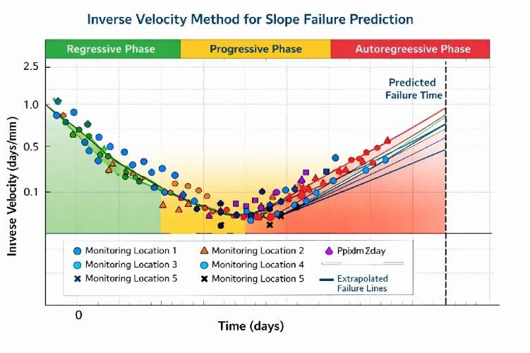
The regressive phase (also called primary creep) occurs early in the failure process. Displacement rates are low and may actually decrease over time as the slope adjusts to stress changes from excavation, rainfall, or other triggers. Many slopes exhibit regressive behavior without ever progressing to failure — the rock mass accommodates the stress change and stabilizes.
The progressive phase (secondary creep) marks the transition toward failure. Displacement rates become steady or slowly increasing, maintaining approximately linear trends over time. This phase can persist for weeks or months, providing extended warning time for operations with adequate monitoring coverage. The length of the progressive phase depends on material properties, stress conditions, and external factors like groundwater fluctuation.
The autoregressive phase (tertiary creep) immediately precedes failure. Displacement rates accelerate exponentially, with the slope effectively committed to collapse once this phase begins. The duration may range from hours to days depending on the failure mechanism. Detection of autoregressive acceleration is the critical trigger for implementing evacuation protocols.
Multi-Point Collaborative Prediction for Sub-Hour Accuracy
The inverse velocity method transforms displacement rate data into failure time predictions. By plotting the inverse of velocity (1/v) against time, analysts observe that approaching failure produces a linear trend converging toward zero. Extrapolating this line to the time axis provides an estimated failure time.
Traditional single-point inverse velocity analysis suffers from noise sensitivity and can produce widely varying predictions depending on which monitoring point is analyzed. Research published in 2025 demonstrates that multi-point collaborative methodologies dramatically improve prediction accuracy by combining observations from multiple measurement points across the unstable zone.
Machine learning approaches, particularly ARIMA (AutoRegressive Integrated Moving Average) models, have achieved prediction accuracy improvements exceeding 90% compared to traditional inverse velocity methods. These algorithms analyze patterns across time series from multiple sensors, identifying subtle correlations that human analysts might overlook.
The 2024 copper-cobalt mine case in Africa demonstrated these capabilities under field conditions. The S-SAR monitoring system deployed in August 2024 tracked continuous deformation across the working face. When accelerating movement indicated imminent failure, the system provided adequate warning for complete evacuation. The August 27 collapse involved seven benches and more than 10,000 square meters of slope face — yet resulted in zero casualties and no property damage because prediction and response systems functioned as designed.
Integrating Prediction Models with Trigger Action Response Plans
Sophisticated prediction algorithms deliver value only when integrated with operational response systems. Trigger Action Response Plans (TARPs) define the specific actions required at each stage of developing instability, removing ambiguity from critical decisions and ensuring consistent response regardless of which personnel are on duty.
Effective TARPs establish escalating response levels tied to quantitative monitoring thresholds. A typical framework uses traffic-light categorization: green status indicates normal operations with routine monitoring; yellow triggers enhanced surveillance, management notification, and review of evacuation procedures; orange requires withdrawal of personnel from the hazard zone, cessation of production activities, and positioning of emergency resources; red mandates immediate evacuation and establishment of exclusion perimeters.
The 2024 North America gold mine failure illustrates the consequences when communication infrastructure fails to support TARP implementation. Ground-based radar systems detected early signs of developing instability on the slope. However, a Wi-Fi repeater that linked the radar to the geotechnical control room had been relocated 14 days before the eventual failure, severing the data transmission path. Radar captured the warning signs, but without data reaching decision-makers, no protective actions were triggered. The resulting failure caused injuries and significant equipment damage — entirely preventable losses had the communication link remained functional.
This case reinforces a critical principle: early warning systems mining operations deploy are only as reliable as their weakest link. Communication infrastructure, power supplies, backup systems, and personnel training all require the same rigorous attention as the sensing technology itself.
Leading InSAR Service Providers for Mining Slope Stability Monitoring
TRE Altamira and the SqueeSAR® Algorithm
TRE Altamira, now part of the CLS Group, pioneered commercial InSAR services beginning in 1993 and remains an industry leader for mining applications. Their proprietary SqueeSAR® algorithm represents the most significant technical advance in InSAR processing of the past decade, dramatically expanding the areas where reliable measurements can be extracted.
Traditional PS-InSAR processing requires stable radar reflectors — hard surfaces like rock outcrops, buildings, or equipment that maintain consistent reflectivity across satellite passes. SqueeSAR® supplements persistent scatterer analysis with distributed scatterer processing, extracting useful signals from areas where traditional methods fail. This capability proves particularly valuable in mining environments where waste dumps, tailings facilities, and recently excavated areas lack the persistent scatterers that conventional processing requires.
TRE Altamira delivers weekly displacement reports integrating observations from multiple satellite sources. Their platform visualizes deformation trends, identifies anomalies requiring investigation, and integrates with ground-based monitoring systems including their partner IDS GeoRadar’s IBIS radar platforms. Mining clients receive not just data but interpreted analysis with geotechnical context, enabling informed decision-making without requiring in-house InSAR expertise.
SkyGeo’s Decision-Grade InSAR Platform
SkyGeo distinguishes itself through emphasis on transforming raw InSAR observations into actionable operational intelligence. Their Antares platform, purpose-built for infrastructure and mining applications, applies automated quality controls and expert interpretation to ensure delivered data meets decision-making requirements.
The platform implements traffic-light alert systems based on configurable velocity thresholds. When displacement rates at any monitoring point exceed defined limits, the system generates automatic notifications to designated personnel. This approach reduces the expertise required for day-to-day monitoring while ensuring critical changes receive immediate attention.
SkyGeo’s service model emphasizes partnership with client geotechnical teams. Regular consultation sessions review monitoring results, assess emerging trends, and adjust surveillance parameters as mine geometry evolves. This collaborative approach ensures monitoring programs remain aligned with operational priorities throughout mine life.
Integrated Solutions: Combining Satellite and Ground-Based Platforms
The most sophisticated monitoring programs leverage strategic partnerships between satellite InSAR providers and ground-based system manufacturers. TRE Altamira’s relationship with IDS GeoRadar exemplifies this integration, enabling seamless data fusion between orbital and terrestrial observations.
Sixense offers the Atlas InSAR platform with explicit multi-sensor integration capabilities. Their system ingests data from all major SAR satellite constellations (Sentinel-1, TerraSAR-X, COSMO-SkyMed, RADARSAT) and combines it with ground-based measurements from any compatible source. The cloud-based visualization environment presents unified displacement maps regardless of data origin.
DARES and Viridien (formerly CGG) bring specialized mining expertise to InSAR services. DARES provides CPT forecast software with integrated inverse velocity analysis, generating slope failure prediction estimates directly from InSAR time series. Viridien’s SatExplorer platform specializes in historical back-analysis, reconstructing years of displacement history for sites where baseline data was never collected during operations.
Case Studies: How Satellite Monitoring Has Prevented Mine Disasters
Copper-Cobalt Mine, Africa (2024): Zero Casualties Through Early Detection
The deployment of an S-SAR monitoring system at an African copper-cobalt mine in August 2024 provided an ideal test case for modern slope stability monitoring technology under challenging field conditions. Within weeks of installation, the system began detecting continuous deformation across a section of the active working face.
Geotechnical staff monitored the developing movement pattern with growing concern as displacement rates increased through the month. The system’s automated analysis algorithms tracked the transition from progressive to accelerating deformation, providing quantitative predictions of failure timing that informed evacuation planning.
On August 27, 2024, the predicted failure materialized. Seven benches collapsed across more than 10,000 square meters of slope face. The event would have been catastrophic had workers remained in the affected zone. Instead, the combination of continuous monitoring, automated prediction, and disciplined TARP implementation achieved the optimal outcome: complete evacuation before failure with zero casualties and no damage to mobile equipment.
This case demonstrates the mature state of mine safety monitoring technology in 2026. The technical capabilities to detect, predict, and respond to slope instability exist and function reliably under operational conditions. Success depends on deployment commitment, system maintenance, communication reliability, and organizational discipline in following response protocols.
Lessons from Network Failures: North America Gold Mine (2024)
The contrasting outcome at a North American gold mine earlier in 2024 illuminates how technology gaps translate to preventable losses. The operation had invested in slope stability radar coverage of the active pit, with sensors positioned to monitor high-risk working areas identified through geotechnical analysis.
The radar system performed its technical function correctly, detecting the early stages of slope movement that would eventually culminate in failure. What failed was the communication infrastructure linking the radar to the mine’s geotechnical control center. A Wi-Fi repeater essential to the data transmission path had been relocated 14 days before the failure event, and the resulting communication gap was not immediately recognized.
For two weeks, the radar captured mounting evidence of developing instability while geotechnical staff received no data. When the failure occurred, the aftermath included personnel injuries and significant equipment damage — losses that continuous data flow would almost certainly have prevented.
The investigation identified multiple contributing factors beyond the immediate communication failure. Redundancy requirements for critical monitoring links had not been clearly defined. Procedures for verifying data continuity after infrastructure changes were inadequate. Alert systems for detecting communication gaps were not configured. Each deficiency represented a correctable organizational gap rather than a technology limitation.
Historical Case: Copper Mine (2016) — Satellite Reveals Hidden Instability
The 2016 copper mine failure described in academic literature provides the most compelling demonstration of satellite InSAR’s unique value proposition. Ground-based radar at this undisclosed operation detected movement on the upper benches of the pit wall and tracked it appropriately. Geotechnical staff assessed the monitored zone and evaluated risk within their visible field of view.
What ground-based systems could not reveal — because the area lay beyond their line of sight — was that the developing instability extended far beyond the pit boundary into natural slope above the mine crest. Satellite deformation monitoring data acquired retrospectively showed that this hidden zone contained the majority of the unstable rock mass, with accelerating movement detectable for nine months before the eventual collapse.
The failure scale exceeded all expectations based on ground radar data precisely because the true failure geometry was invisible to surface-based instruments. Satellite InSAR, with its orbital vantage point, would have revealed the complete picture had it been deployed during the development phase.
This case fundamentally changed industry thinking about monitoring program design. Ground-based radar remains essential for real-time tactical response, but satellite InSAR provides irreplaceable strategic context. Modern best practice deploys both technologies with explicit recognition of their complementary capabilities.
Don’t Wait for a Slope Failure to Invest in Monitoring
Our InSAR specialists analyze your mine site remotely and deliver actionable displacement reports within days. Historical analysis back to 2015 available for existing operations — no equipment installation required.
Implementing a Slope Stability Monitoring Program in 2026
Assessing Your Mine’s Monitoring Requirements
Effective slope stability monitoring programs begin with systematic assessment of site-specific risk factors, regulatory requirements, and operational constraints. No standard template applies universally — monitoring investment must reflect the actual hazard profile of each operation.
Pit depth and slope geometry establish baseline risk levels. Deeper pits with steeper overall slope angles concentrate higher stress at the toe while exposing more rock mass to potential failure. Complex geological structures — faults, shear zones, unfavorable joint orientations — increase uncertainty and demand more intensive surveillance. Climate patterns, particularly rainfall intensity and seasonal groundwater fluctuation, affect triggering probability.
Regulatory requirements vary significantly by jurisdiction. Australian operations under DMIRS oversight face specific requirements for geotechnical monitoring programs, reporting, and record keeping. Chilean mines operating under SERNAGEOMIN regulations must demonstrate continuous surveillance capabilities. Canadian provincial regulators impose differing requirements that mining operations must navigate according to specific jurisdictional context. United States MSHA regulations address ground control broadly, with increasing attention to monitoring adequacy following major incidents.
The starting point for most operations should be a baseline InSAR assessment using historical satellite data. This analysis, requiring no site access or equipment installation, reveals existing deformation patterns across the mine footprint and surrounding areas. Results inform decisions about ground-based radar positioning, prism network design, and priority zones for enhanced surveillance.
Designing a Multi-Technology Monitoring Strategy
Mature slope stability monitoring programs integrate multiple technologies, each contributing unique capabilities while compensating for others’ limitations. A typical deployment for a large open-pit operation in 2026 might include satellite InSAR coverage of the entire mine property including surrounding natural slopes, processing on weekly or bi-weekly intervals to track long-term trends and detect emerging anomalies.
Ground-based radar systems deploy at active working faces and zones identified through InSAR analysis as requiring real-time surveillance. Positioning requires careful geometric analysis to ensure coverage of priority areas while minimizing blind spots. Multiple radar units may be necessary for large or geometrically complex pits.
Robotic total stations with automated prism tracking provide independent displacement measurements at critical benchmarks. These systems operate with higher precision than either InSAR or ground radar, though at far fewer measurement points. Prism data validates satellite observations and provides ground-truth calibration.
Piezometer networks monitor groundwater conditions in slopes where hydrogeological factors influence stability. Elevated pore pressures reduce effective stress and factor prominently in many failure mechanisms. Automated data loggers with telemetry links enable real-time pressure monitoring integrated with displacement data.
All data streams feed into unified visualization platforms where geotechnical staff can correlate observations, identify discrepancies requiring investigation, and maintain comprehensive situational awareness. The goal is a single coherent picture of slope behavior rather than fragmented views from isolated monitoring silos.
ROI Considerations: Prevention vs. Remediation Costs
Economic analysis strongly favors proactive slope stability monitoring investment over reactive response to failures. The arithmetic is straightforward once realistic cost estimates are applied to plausible scenarios.
Ground patrol and visual inspection programs, while providing value for detecting surface conditions like tension cracks or seepage, cannot match the continuous surveillance capability of automated monitoring. Operations that have transitioned from patrol-based programs to satellite and radar monitoring report elimination of significant patrol costs while achieving far superior hazard detection.
Insurance considerations increasingly favor operations demonstrating comprehensive monitoring programs. Underwriters recognize that continuous surveillance reduces both the probability of catastrophic events and the severity of outcomes when failures do occur. Premium reductions partially offset monitoring investment for operations that document their capabilities appropriately.
The ultimate ROI driver is production continuity value. A major slope failure can halt operations for months while debris is cleared, stability is reassessed, and remediation measures are implemented. Equipment burial may result in total losses. Regulatory consequences may constrain future operations. Reputation effects may impair community relations and permitting for expansions.
Against these potential losses measured in tens or hundreds of millions of dollars, annual satellite InSAR monitoring costs of $20,000 to $75,000 represent negligible investment. Ground-based radar systems require larger capital commitment ($150,000 to $500,000+ per unit plus operating costs), but generate corresponding value through real-time tactical protection of workers and equipment.
Frequently Asked Questions About Slope Stability Monitoring
How far in advance can satellite InSAR detect slope failure?
Satellite InSAR has demonstrated the ability to detect precursory deformation months before catastrophic slope failures occur. In the well-documented case of an undisclosed copper open-pit mine that failed in November 2016, satellite data acquired retrospectively revealed accelerating creep behavior detectable nine months before the eventual collapse. Similarly, retroanalysis of the Brumadinho tailings dam disaster demonstrated that satellite deformation monitoring could have identified warning signs at least five months before the catastrophic liquefaction failure.
The actual warning time depends significantly on the failure mechanism involved. Progressive failures that develop through gradual stress accumulation and crack propagation typically provide extended warning periods highly amenable to InSAR detection. Brittle failures triggered by sudden events like earthquakes or rapid rainfall infiltration may progress more quickly, though even these typically exhibit precursory deformation if monitoring coverage exists.
For operational slope stability monitoring programs, combining satellite InSAR for long-term trend detection with ground-based radar for real-time alerting provides the most comprehensive early warning capability. Satellite data identifies developing problem areas and informs ground radar positioning, while ground radar provides the high-frequency observations necessary for detecting final acceleration phases and triggering evacuation protocols.
What is the typical cost of InSAR monitoring for a mine site?
Satellite InSAR monitoring services for mining operations typically range from $20,000 to $75,000 per year depending on several configurable factors. The monitored area size directly affects cost, with larger footprints requiring more satellite data and processing effort. Choice of satellite data sources influences pricing: services based primarily on free Sentinel-1 data cost less than those incorporating commercial high-resolution satellites like TerraSAR-X or COSMO-SkyMed.
Reporting frequency affects both data acquisition and processing costs. Monthly monitoring updates cost less than bi-weekly or weekly deliveries. The level of geotechnical interpretation included in deliverables also varies: basic displacement maps cost less than reports incorporating expert analysis, trend assessment, and risk recommendations.
For context, ground-based slope stability radar systems require capital investment of $300,000 to $700,000 per unit, plus ongoing maintenance, calibration, power, and staffing costs that typically exceed $100,000 annually per system. Large mines may require multiple radar units to provide adequate coverage, multiplying both capital and operating expenses.
From a cost-effectiveness perspective, satellite InSAR provides exceptional value for wide-area monitoring and historical trend analysis. Ground radar investments are justified for real-time alerting in the highest-risk active working zones. Most operations benefit from deploying both technologies in complementary roles rather than choosing one over the other.
Can satellite monitoring replace ground-based radar systems entirely?
No — satellite InSAR and ground-based radar serve complementary roles in comprehensive geotechnical monitoring programs, and neither technology fully substitutes for the other. Satellite InSAR provides wide-area coverage, historical analysis capabilities dating back decades, and the ability to monitor areas invisible to ground-based systems such as natural slopes above pit crests. However, satellite revisit times of 6-12 days (for Sentinel-1) are insufficient for detecting the rapid accelerations that immediately precede failure.
Ground-based radar systems like GroundProbe SSR or IDS GeoRadar IBIS provide scan updates every 2-40 minutes, generating the high-frequency data essential for implementing Trigger Action Response Plans and executing timely evacuations. The inverse velocity method for slope failure prediction requires this high-frequency data to identify autoregressive acceleration phases that may last only hours or days.
Industry best practice uses satellite InSAR for site-wide screening and long-term trend analysis, identifying areas of concern that warrant enhanced surveillance. Ground-based radar then deploys at active working faces and zones flagged by satellite analysis as elevated risk. This layered approach eliminates blind spots while ensuring real-time protection where workers are most exposed.
The 2016 copper mine case discussed earlier demonstrates the danger of relying solely on ground-based systems. The radar detected movement within its field of view while missing the larger instability developing above the pit crest. Satellite coverage would have revealed the complete failure geometry, potentially enabling a different outcome.
How does weather affect InSAR measurements?
One of the primary advantages of SAR (Synthetic Aperture Radar) technology is operation in the microwave spectrum, which penetrates clouds, rain, dust, and smoke with minimal attenuation. Unlike optical satellite imagery that requires clear skies for useful observations, InSAR measurements can be acquired day or night, in any weather conditions. This makes satellite radar particularly valuable for mining operations in tropical regions with frequent cloud cover, monsoon climates with extended wet seasons, or arid environments prone to dust storms.
However, certain surface conditions can affect measurement quality even when atmospheric conditions are favorable. Heavy vegetation growth between satellite passes can cause temporal decorrelation, reducing the coherence necessary for reliable phase measurements. Similarly, very rapid surface changes from active mining excavation can disrupt InSAR coherence on recently worked benches.
In practice, DInSAR open pit applications work well on stable benches, haul roads, waste dumps, and tailings dam embankments where surface conditions remain reasonably consistent between satellite acquisitions. Areas undergoing active excavation may exhibit reduced measurement density but typically stabilize as mining moves elsewhere. Processing algorithms like SqueeSAR® have improved performance in challenging environments by exploiting distributed scatterers in addition to traditional persistent scatterer techniques.
What training do geotechnical teams need for InSAR interpretation?
Effective use of satellite InSAR data requires understanding both the technology’s capabilities and its inherent limitations. Service providers including TRE Altamira, SkyGeo, and Sixense offer training programs covering fundamental concepts of satellite deformation monitoring, data interpretation best practices, and integration with existing slope stability monitoring workflows.
Key competencies for geotechnical staff include understanding line-of-sight (LOS) displacement measurements versus true vertical and horizontal motion vectors. InSAR measures movement toward or away from the satellite along its viewing geometry — translating these measurements to actual ground motion requires knowledge of failure mechanisms and slope orientation. Recognizing atmospheric artifacts that can mimic ground movement is essential for avoiding false alarms. Correlating InSAR observations with geological structure, groundwater conditions, and operational activities enables meaningful interpretation of displacement patterns.
For organizations new to satellite monitoring, partnering with experienced service providers who deliver interpreted reports with actionable recommendations is typically more effective than attempting immediate in-house processing of raw satellite data. As internal expertise develops through working with interpreted products, teams can transition toward more independent data analysis while maintaining expert consultation for complex interpretation challenges.
Most mining operations find that six months of working with provider-delivered reports builds sufficient familiarity for staff to contribute meaningfully to interpretation discussions. Full independent analysis capability typically requires 12-24 months of experience plus access to specialized processing software — a level of investment that makes sense only for the largest operations or companies managing multiple mine sites.
Conclusion
The evolution of slope stability monitoring technology over the past two decades has fundamentally transformed what is possible for mine safety programs. Where operations once relied on periodic visual inspections, scattered prism networks, and reactive response to visible distress, modern mines now access continuous millimeter-scale displacement measurements across entire pit footprints and surrounding terrain.
The contrast between preventable disasters and successful evacuations reduces to a simple distinction: monitoring coverage and organizational discipline in response. Bingham Canyon’s 2013 slide — the largest slope failure in mining history at 144 million tons — resulted in zero casualties because months of continuous monitoring enabled complete evacuation. Xinjing’s 2023 collapse killed 53 workers because warning signs that satellite data could have revealed went undetected.
In 2026, the technical capabilities for effective slope failure prediction are mature and operationally proven. Satellite InSAR provides wide-area surveillance detecting developing instabilities months before visible distress appears. Ground-based radar mining systems deliver real-time tactical alerting in active work zones. Machine learning algorithms achieve prediction accuracy that enables sub-hour failure timing estimates. Integration platforms fuse multiple data streams into unified situational awareness.
The remaining challenge is organizational rather than technical: committing to continuous monitoring investment, maintaining communication infrastructure reliability, training personnel in response protocols, and building cultures that prioritize early warning over reactive response. For mining operations worldwide, the path forward is clear. The technology to prevent slope disasters exists and functions reliably under operational conditions. Implementation decisions now determine outcomes.