Mining
Advanced Mining Monitoring & Remote Sensing Services
Satellite-based slope stability monitoring, tailings management, stockpile measurement, and mineral exploration for safe, efficient mining operations
Get StartedComprehensive Mining Monitoring Solutions Using Satellite Technology
SkyIntelGroup provides professional mining monitoring services powered by advanced satellite remote sensing. Our solutions include slope stability monitoring, tailings management, stockpile measurement, and tailings dam monitoring to ensure operational safety, regulatory compliance, and environmental protection across mining operations worldwide.
From mineral exploration and mine closure planning to environmental impact monitoring and illegal mining detection, our satellite-based technology delivers millimeter-precision measurements for comprehensive remote sensing mining applications. We serve mining operators, exploration companies, and environmental managers with reliable monitoring solutions for safe, sustainable mineral extraction.
Our Mining Monitoring & Exploration Services
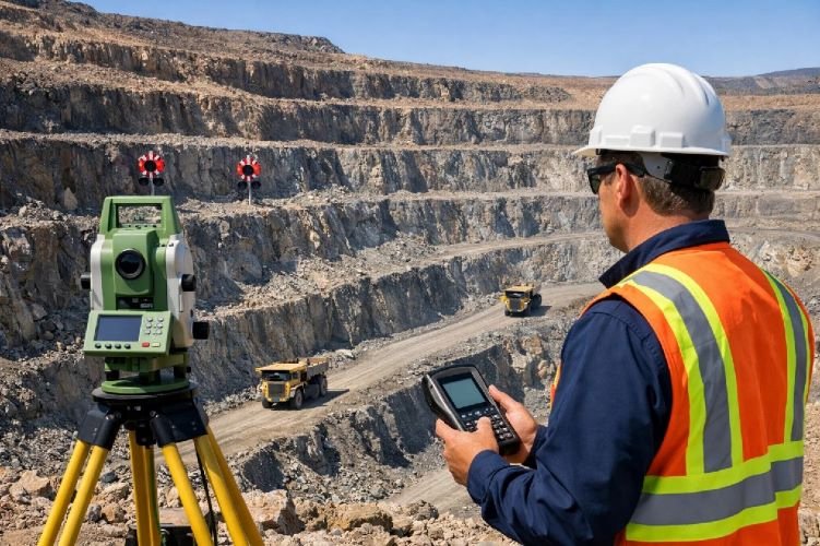
Slope Stability Monitoring with InSAR/DInSAR
Prevent catastrophic pit wall failures with millimeter-precision slope stability monitoring using Differential Interferometric Synthetic Aperture Radar (DInSAR). Our service detects precursor movements in open pit mine walls months before collapse, providing early warning alerts that save lives and prevent production shutdowns.
Essential for open pit slope stability management, this technology tracks deformation in terraced pit walls, waste dumps, and highwall slopes with 1-2mm precision. Applied successfully in major mining regions including Australia, Chile, Canada, and South Africa, our monitoring prevents the massive financial and safety consequences of slope failures in open pit operations.
Key Benefits
- Detects movement months before slope failure
- 1-2mm precision deformation measurement
- $428M market growing to $1B+ by 2032
- Prevents production shutdowns and saves lives
- Continuous monitoring of entire pit walls
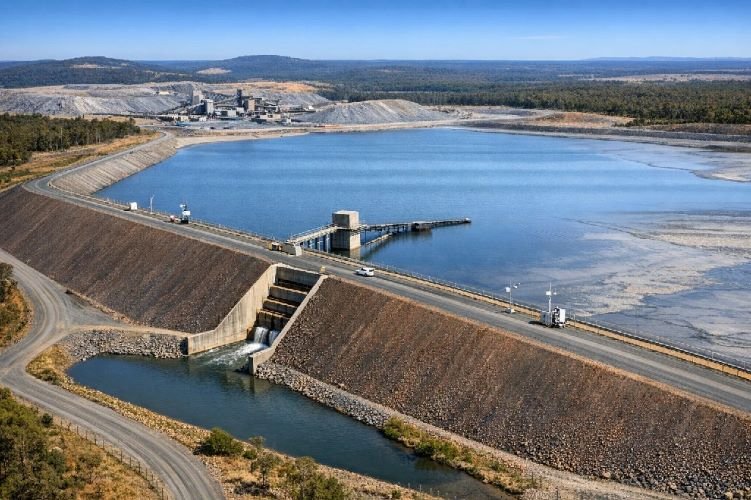
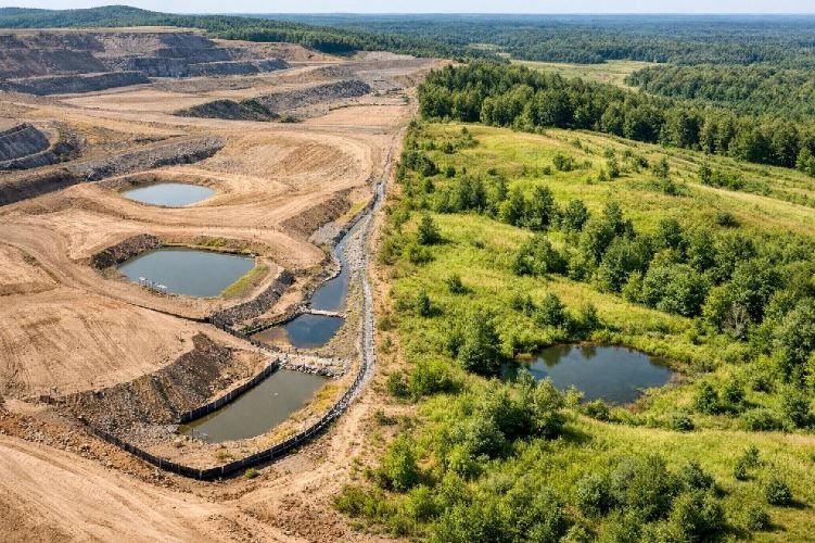
Tailings Dam Monitoring & Failure Prevention
Protect communities and the environment with continuous tailings dam monitoring of Tailings Storage Facilities (TSF). Our DInSAR technology detects structural deformations, differential settlements, and early warning signs of catastrophic failure in tailings dams, preventing disasters like Brumadinho and Mount Polley.
Critical for tailings management compliance with the Global Industry Standard on Tailings Management (GISTM), this service is now mandatory for responsible mining operations. Satellite monitoring provides independent verification for regulators and enables parametric insurance models, with early detection capability demonstrated 5+ months before historical failures.
Key Benefits
- Mandatory for GISTM compliance post-Brumadinho
- Early detection 5+ months before failure
- Independent verification for regulators and insurers
- Prevents environmental and human disasters
- Supports parametric insurance premium reduction
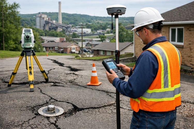
Ground Subsidence Monitoring (Underground Mining)
Monitor surface deformation caused by underground mining operations with precision DInSAR technology. This service tracks subsidence induced by longwall mining, block caving, and room-and-pillar extraction methods, protecting surface infrastructure including buildings, roads, pipelines, and water resources from mining subsidence damage.
Essential for coal mine subsidence and underground metalliferous mining operations, our monitoring detects settlement rates exceeding 70cm/year in urbanized areas. The technology maps complete subsidence basins that often extend hundreds of meters beyond the mined area, enabling proactive protection of critical infrastructure and community assets.
Key Benefits
- Protects surface infrastructure from underground mining
- Maps complete subsidence basins beyond mined area
- Detects rapid subsidence up to 70cm/year
- Critical for longwall and block caving operations
- Prevents infrastructure damage and liability claims
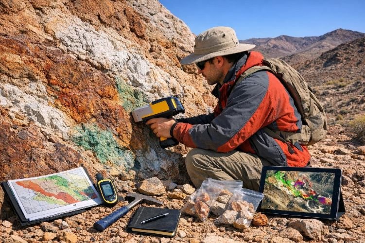
Mineral Exploration with Hyperspectral Imaging
Identify mineral exploration targets remotely using hyperspectral satellite imaging that detects spectral signatures of valuable minerals including gold, copper, rare earth elements, and base metals. This technology analyzes 200+ spectral bands to identify alteration zones and mineralization indicators without expensive ground exploration.
By detecting mineral signatures from space, exploration companies reduce field investigation areas by up to 90%, focusing resources on high-probability zones. This cost-effective approach to exploration target generation accelerates discovery while minimizing environmental footprint and exploration expenditure before drilling commitments.
Key Benefits
- Reduces exploration area by 90% before drilling
- Detects gold, copper, rare earths remotely
- Analyzes 200+ spectral bands for mineralization
- Accelerates discovery and reduces costs
- Minimizes environmental exploration footprint
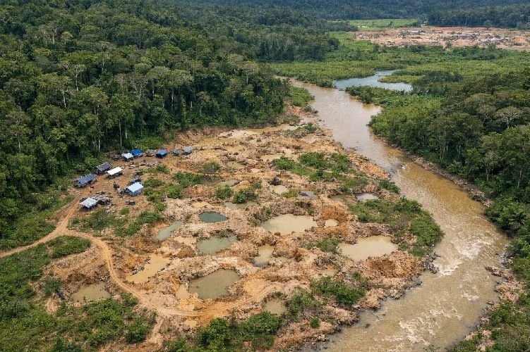
Illegal Mining Detection & Compliance Monitoring
Combat unauthorized mineral extraction with automated detection of illegal mining activity using daily satellite imagery and AI-powered change detection. Our system identifies new excavations, access roads, equipment, and mining camps in protected areas or legal concessions, enabling rapid response and enforcement action.
Applied successfully by UNODC and environmental authorities in Amazon regions, this service provides forensic evidence by comparing current imagery with 20-year historical archives. Studies show that announced satellite surveillance alone reduces illegal mining by 7% through deterrence, while active monitoring enables targeted enforcement in remote, inaccessible regions.
Key Benefits
- Detects unauthorized mining in remote areas
- AI-powered change detection with YOLO algorithms
- 7% reduction through surveillance deterrence effect
- Forensic evidence with 20-year historical comparison
- Protects concession boundaries and environment
Environmental Impact Monitoring & ESG Compliance
Demonstrate environmental responsibility with comprehensive monitoring of deforestation, water contamination, vegetation health, and ecosystem impacts around mine sites. Using NDVI analysis, spectral water quality assessment, and change detection, this service provides objective evidence for ESG compliance and regulatory reporting.
Our environmental monitoring detects acid mine drainage signatures, quantifies forest cover loss, and tracks vegetation stress from heavy metal absorption or toxic gas exposure. This independent verification system builds stakeholder trust, supports sustainability reporting, and enables proactive mitigation before environmental incidents escalate into regulatory penalties or community conflicts.
Key Benefits
- Objective evidence for ESG compliance reporting
- Detects acid mine drainage and water contamination
- Quantifies deforestation and vegetation impacts
- Builds stakeholder and community trust
- Enables proactive environmental mitigation
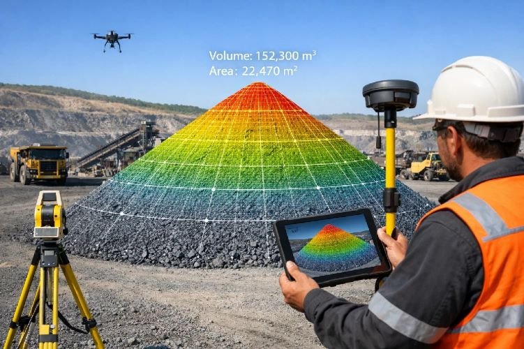
Stockpile Volume Calculation & Production Estimation
Optimize inventory management with accurate stockpile measurement using satellite stereo-pair photogrammetry. Our service generates 3D Digital Surface Models (DSM) of ore and waste stockpiles with less than 5% volume calculation error, enabling precise production tracking and financial reporting without ground surveys.
Using high-resolution satellites like WorldView-3 (30cm resolution), we deliver weekly or monthly stockpile volume calculation for multiple sites simultaneously. This technology supports logistics planning, production verification, and financial transparency while eliminating costly manual surveys with total stations or drones at individual mine locations.
Key Benefits
- Less than 5% volume calculation error
- Weekly/monthly measurements without ground access
- Supports financial reporting and production tracking
- Eliminates costly manual survey requirements
- Monitors multiple sites simultaneously from space
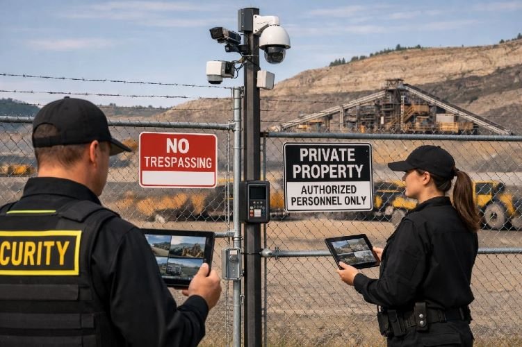
Mine Site Security & Encroachment Detection
Protect valuable mining assets with automated detection of unauthorized personnel, vehicles, and equipment entering concession boundaries. Using optical satellite imagery combined with YOLO object detection algorithms, this security service identifies intrusions, equipment theft, and encroachment on mineral rights 24/7.
Particularly valuable for remote mine sites where physical security is challenging, our surveillance system provides continuous monitoring without expensive on-site personnel. Change detection algorithms automatically flag new structures, vehicle tracks, or suspicious activity, supporting security response and legal documentation of boundary violations.
Key Benefits
- 24/7 remote monitoring of mine boundaries
- AI-powered detection of vehicles and equipment
- Protects assets in remote, difficult-to-access sites
- Prevents equipment theft and unauthorized access
- Provides legal documentation of violations
Mine Reclamation & Closure Monitoring
Verify successful land rehabilitation and support environmental bond release with satellite-based mine closure planning monitoring. Using NDVI time-series analysis and the Reclamation Activity Index (RAI), this service objectively measures revegetation success, achieving 94% accuracy in identifying areas ready for regulatory bond release.
Our monitoring tracks vegetation establishment, terrain stability, water quality, and topographic compliance year-over-year, replacing costly helicopter surveys. This service supports regulatory compliance, accelerates bond release, and demonstrates successful restoration to stakeholders, enabling mining companies to exit closed sites responsibly and recover financial guarantees.
Key Benefits
- 94% accuracy identifying bond-release readiness
- Objective measurement of revegetation success
- Replaces expensive helicopter survey flights
- Accelerates environmental bond release
- Demonstrates responsible mine closure to regulators
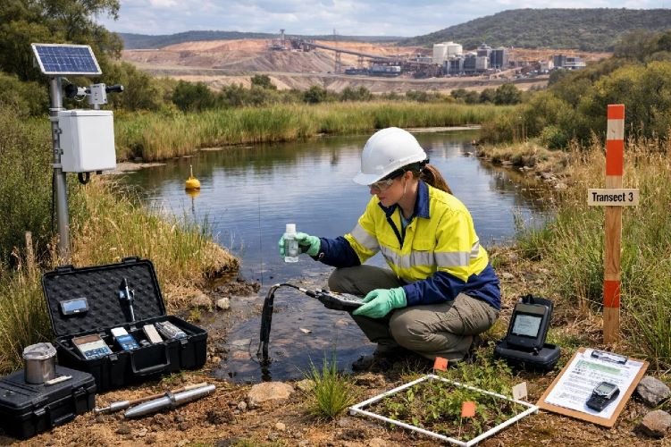
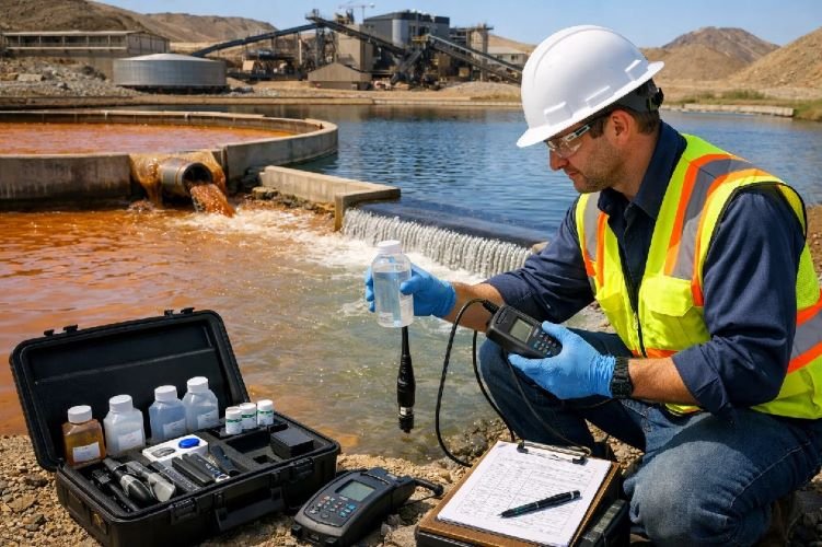
Water Management & Quality Monitoring
Monitor mine water quality and detect contamination in rivers, lakes, and groundwater near mining operations using hyperspectral and thermal satellite imaging. This service identifies acid mine drainage (AMD) signatures, measures water turbidity, detects iron oxide and sulfate contamination, and tracks seepage from tailings facilities.
By analyzing spectral reflectance in Short-Wave Infrared (SWIR) bands, our system detects chemical signatures of mine-affected water, enabling proactive mitigation before environmental damage escalates. This monitoring supports water management compliance, protects downstream communities, and provides early warning of tailings dam seepage or treatment system failures.
Key Benefits
- Detects acid mine drainage signatures remotely
- Monitors water contamination without field sampling
- Early detection of tailings dam seepage
- Protects downstream water resources
- Supports environmental compliance reporting
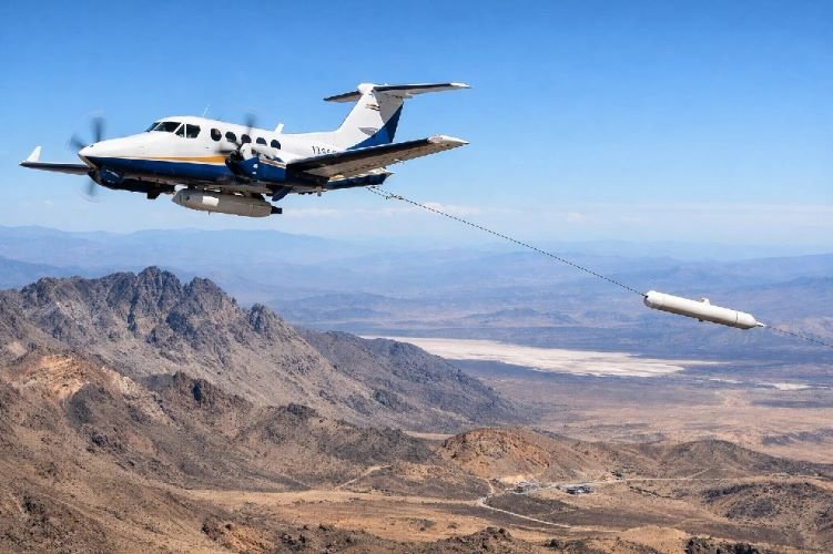
Airborne Geophysical Surveys (Magnetic + Gravity)
Accelerate mineral exploration and reduce drilling costs with airborne aeromagnetic survey and gravity surveys that detect buried ore bodies before expensive ground programs. Our partner-operated aircraft fly magnetometers and gravimeters over sedimentary basins to map salt domes, basement structures, and magnetic anomalies indicating metallic mineralization.
This proven exploration method reduces target areas from 100 hectares to 10 high-priority zones, saving millions in unnecessary drilling. While our Colombian partner handles airborne data acquisition, SkyIntelGroup provides expert processing and geological interpretation, delivering comprehensive exploration intelligence for gold, copper, iron, nickel, and hydrocarbon trap identification.
Key Benefits
- Reduces exploration drilling costs by 90%
- Detects buried ore bodies before ground programs
- Maps regional geological structures rapidly
- Proven for gold, copper, iron, nickel exploration
- Partner acquisition with expert interpretation
Why Choose Satellite-Based Mining Monitoring?
Safety & Risk Prevention
Millimeter-precision monitoring detects slope failures, tailings dam deformation, and subsidence months before catastrophic events. Protect lives, prevent production shutdowns, and meet GISTM safety standards with continuous satellite surveillance.
Cost-Effective Operations
Reduce exploration costs by 90%, eliminate manual stockpile surveys, and replace helicopter flights for reclamation monitoring. Satellite technology delivers superior coverage and frequency at a fraction of traditional ground-based monitoring costs.
ESG Compliance & Transparency
Independent environmental monitoring, objective reclamation verification, and continuous tailings dam surveillance demonstrate responsible mining to regulators, investors, and communities. Reduce insurance premiums and accelerate bond release with certified monitoring.
Ready to Enhance Your Mining Safety & Efficiency?
Join leading mining companies worldwide using satellite technology for slope stability monitoring, tailings management, and mineral exploration to improve safety, reduce costs, and ensure compliance.
Contact Us Today