Subsidence Monitoring: The Complete Guide to Detecting Ground Movement Before It’s Too Late (2026)
In May 2025, a landmark study published in Nature Cities revealed a sobering reality: over 20% of urban areas in the 28 most populous U.S. cities are actively sinking, placing more than 29,000 buildings at high risk of structural damage. This slow-moving hazard affects approximately 34 million people—and most of them don’t even know it’s happening beneath their feet.
Subsidence, the gradual sinking or settling of the Earth’s surface, has long been one of construction’s most underestimated risks. Unlike earthquakes or floods that announce themselves dramatically, subsidence operates invisibly, millimeter by millimeter, until cracks appear in walls, foundations shift, and repair costs spiral into the hundreds of thousands of dollars. The traditional approach—waiting for visible damage before taking action—is not just inefficient; it’s financially devastating.
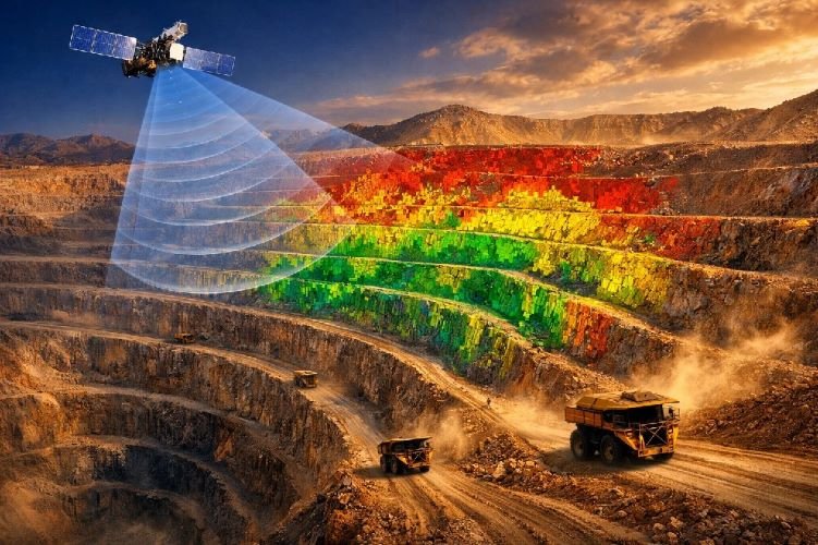
The good news? 2026 marks a turning point. Advances in satellite radar technology, particularly DInSAR (Differential Interferometric Synthetic Aperture Radar), now enable engineers and project managers to detect ground movement with millimeter precision across entire regions—without ever setting foot on site. This guide provides everything you need to understand subsidence monitoring: the science behind it, the methods available, and how to implement a monitoring program that protects your projects, your infrastructure, and your bottom line.
What Is Subsidence and Why Should You Care?
Understanding Ground Subsidence
Ground subsidence monitoring begins with understanding what we’re actually measuring. Subsidence refers to the downward movement of the ground surface relative to a fixed datum. Unlike settlement—which describes the expected compression of soil under the weight of a new structure—subsidence involves broader geological changes that can affect entire neighborhoods, infrastructure networks, and natural landscapes.
The distinction matters because settlement is predictable and typically stabilizes within a few years of construction, while subsidence can continue for decades and accelerate without warning. Differential subsidence, where different parts of a structure or area sink at different rates, poses the greatest threat to structural integrity because it creates uneven stress distributions that buildings were never designed to handle.
Ground movement rates vary dramatically depending on the cause. Natural consolidation of sediments might produce 1-2 mm of movement per year, barely noticeable over a human lifetime. Active groundwater extraction in susceptible soils can generate 10-40 mm annually. In extreme cases like Mexico City, rates have reached 400 mm per year—nearly half a meter of sinking every twelve months.
Common Causes of Land Subsidence
Understanding what drives land subsidence monitoring requirements is essential for both prevention and effective detection. The causes fall into three broad categories: natural geological processes, human activities, and hybrid factors.
Groundwater extraction stands as the single largest cause, responsible for more than 80% of serious subsidence problems in the United States according to the U.S. Geological Survey. When water is pumped from aquifers faster than natural recharge can replace it, the pore spaces within clay and silt layers compress permanently. This compaction is often irreversible—once the ground sinks, it rarely recovers even if water levels are restored.
Underground construction and tunneling have emerged as increasingly significant factors in urban areas. Subway excavation, utility installations, and deep foundation work disturb soil stability and alter groundwater flow patterns. Studies in Guangzhou, Shanghai, and Tokyo have documented subsidence rates exceeding 8 mm per year directly above newly excavated metro tunnels.
Mining activities create underground voids that can collapse decades after operations cease. Historical mining regions across the UK, Germany, and the United States continue to experience subsidence from abandoned shafts that were never properly backfilled. Oil and gas extraction similarly reduces underground pressure, allowing overlying formations to compact.
Natural processes also contribute. Clay soils shrink significantly when moisture content drops, a phenomenon exacerbated by tree roots drawing water from the ground near buildings. Karst terrain, underlain by soluble limestone, can develop sinkholes with little warning as underground cavities enlarge and eventually collapse.
The Real Cost of Undetected Subsidence
The financial consequences of ignoring proper subsidence risk assessment extend far beyond simple repair costs. When ground movement goes undetected, what might have been addressed with early intervention methods like resin injection—typically costing a few thousand dollars—can escalate into full underpinning projects exceeding £250,000 (approximately $320,000).
Insurance claims tell part of the story. During the 2022 subsidence surge in the UK, claim volumes increased by 500% in a single month. The average claim cost rose 14% because delayed detection meant more extensive damage. Industry analysts estimate that proactive monitoring programs could reduce total subsidence-related costs by 40-60% simply by enabling earlier intervention.
Beyond direct repair expenses, subsidence creates secondary costs that are often overlooked: business interruption during remediation work, legal liability when adjacent properties are affected, decreased property values, and the engineering resources required for emergency assessments. For infrastructure projects, subsidence can trigger regulatory violations, construction delays, and contractual disputes that multiply the financial impact.
Traditional vs. Modern Subsidence Monitoring Methods
Ground-Based Monitoring Techniques
For decades, engineers have relied on established subsidence monitoring methods based on ground instrumentation. These techniques remain valuable for site-specific applications but come with significant limitations when broader coverage is needed.
Precise leveling surveys use optical instruments to measure elevation differences between benchmarks with sub-millimeter accuracy. A surveyor establishes reference points on stable ground, then measures how target points move relative to these references over time. While highly accurate at individual locations, leveling is labor-intensive, weather-dependent, and provides data only at discrete points rather than continuous spatial coverage.
Extensometers measure the compaction of specific soil layers by anchoring a rod deep in stable bedrock and monitoring how the surface moves relative to this fixed reference. The USGS considers extensometers the gold standard for measuring aquifer compaction because they isolate vertical movement from other geological processes. However, installation requires drilling boreholes—often several hundred feet deep—making extensometers expensive to deploy and impractical for most construction projects.
GPS and GNSS monitoring provides continuous position data at fixed stations with centimeter-level accuracy. Differential GPS (DGPS) networks have proven valuable for mining operations where regulations require documented evidence of ground stability. The technology excels at capturing sudden movements but requires physical infrastructure at each monitoring point.
Crack monitors, known as tell-tales in the UK, track the opening and closing of existing cracks in structures. These simple devices consisting of two overlapping plates show whether a crack is actively growing, seasonal (responding to temperature changes), or stable. Structural engineers use crack monitoring data to determine whether observed damage represents ongoing movement or historical settlement that has stabilized.
Satellite-Based Monitoring: The Game Changer
Satellite radar technology has fundamentally transformed what’s possible in ground deformation monitoring. Interferometric Synthetic Aperture Radar (InSAR) and its differential variant (DInSAR) can detect ground movement across hundreds of square kilometers simultaneously, with precision matching or exceeding traditional survey methods.
The technology works because radar signals are exquisitely sensitive to changes in distance. A satellite transmits microwave pulses toward Earth and records the reflected signal, including its phase—the position of the wave within its cycle when it returns. By comparing phase measurements from images captured weeks or months apart, analysts can calculate how much the ground has moved in the interval, often resolving changes as small as 1-2 millimeters per year.
Unlike optical sensors, radar penetrates clouds and operates equally well at night, providing all-weather, day-or-night monitoring capability. This reliability matters for construction projects where weather delays in data collection could create dangerous blind spots in the monitoring record.
The coverage advantage is equally significant. A single Sentinel-1 satellite image covers approximately 250 km × 250 km—an area that would require thousands of ground survey points to monitor at equivalent spatial density. For linear infrastructure like railways, pipelines, or highways, satellite monitoring can track the entire corridor in a single analysis rather than requiring separate surveys at discrete locations.
| Method | Precision | Coverage | Frequency | Best Application |
|---|---|---|---|---|
| Precise Leveling | ±0.1-1 mm | Point measurements | Monthly campaigns | Benchmark validation |
| Extensometers | ±0.01-0.1 mm | Single location | Continuous | Aquifer compaction studies |
| DGPS Networks | ±1-5 mm | Station network | Continuous | Mining regulatory compliance |
| Crack Monitors | ±0.1-1 mm | Individual cracks | Periodic readings | Structural damage assessment |
| DInSAR/InSAR | ±1-2 mm/year | Regional (100s km²) | Every 6-12 days | Wide-area infrastructure monitoring |
How DInSAR Technology Works for Subsidence Detection
The Science Behind Differential InSAR
DInSAR represents the most significant advancement in ground subsidence monitoring technology of the past two decades. The technique builds on standard InSAR by using a digital elevation model to remove topographic contributions from the phase signal, isolating the component that represents actual ground displacement.
The process begins when a satellite equipped with Synthetic Aperture Radar passes over an area, transmitting microwave pulses and recording the echoes. Each pixel in the resulting image contains both amplitude information (how much energy returned) and phase information (where the returning wave was in its cycle). When the satellite passes over the same area days or weeks later, it captures another image from nearly the same orbital position.
By comparing the phase values between these two acquisitions, analysts create an interferogram—a map showing phase differences across the entire scene. Where the ground has moved toward or away from the satellite, the phase difference reveals the magnitude of displacement. With radar wavelengths typically around 5.6 cm (C-band) or 24 cm (L-band), even millimeter-scale movements produce measurable phase shifts.
Advanced techniques like Persistent Scatterer InSAR (PS-InSAR) and Small Baseline Subset (SBAS) have pushed accuracy even further. These methods analyze dozens or hundreds of images over time, identifying stable reflection points—typically buildings, infrastructure, or exposed rock—that maintain consistent radar characteristics across all acquisitions. By tracking these persistent scatterers through time, analysts can reconstruct displacement histories with submillimeter precision.
From Raw Data to Actionable Insights
The journey from satellite acquisition to engineering decision involves several processing stages. Raw radar data first undergoes focusing to create a usable image, then co-registration to align multiple acquisitions to the same geographic grid. Interferogram generation follows, producing the characteristic fringe patterns that represent phase differences.
Atmospheric correction represents a critical step that separates professional analysis from amateur attempts. Water vapor in the atmosphere delays radar signals unpredictably, introducing noise that can mask or mimic ground movement. Sophisticated algorithms estimate and remove these atmospheric effects by analyzing spatial patterns and comparing multiple image pairs.
The final products typically include velocity maps showing average displacement rates in millimeters per year, time series graphs tracking individual points through the monitoring period, and classified risk maps highlighting areas exceeding defined movement thresholds. These outputs integrate directly into engineering workflows, providing the quantitative data needed for informed decision-making.
Precision and Limitations: What to Expect
Honest assessment of capabilities and limitations distinguishes reliable settlement monitoring from oversold promises. Under favorable conditions—urban areas with abundant persistent scatterers, minimal vegetation, and stable atmospheric conditions—DInSAR routinely achieves 1-2 mm/year accuracy for velocity measurements and 2-3 mm precision for individual displacement measurements.
Several factors can degrade performance. Dense vegetation changes between acquisitions, causing decorrelation that prevents reliable phase comparison. Snow cover creates similar problems. Very rapid movements—exceeding roughly one-quarter of the radar wavelength between passes—can cause phase unwrapping errors that lead to incorrect displacement estimates.
Geometry also matters. Radar satellites measure movement only along their line of sight, typically 20-40 degrees from vertical. Purely horizontal movement perpendicular to the satellite track may be invisible, while movement toward or away from the sensor is captured most accurately. For comprehensive three-dimensional displacement monitoring, data from multiple orbital geometries or integration with ground-based measurements becomes necessary.
These limitations don’t diminish the technology’s value—they define appropriate applications. DInSAR excels at detecting and quantifying gradual subsidence over wide areas, providing early warning of developing problems, and establishing baseline conditions before construction begins. For the highest-risk structures or fastest-moving areas, it complements rather than replaces targeted ground instrumentation.
How DInSAR Processing Works
Key Applications of Subsidence Monitoring
Urban Infrastructure and Buildings
Cities concentrate both subsidence risk and the assets most vulnerable to its effects. Urban ground deformation monitoring has become essential for municipalities, developers, and infrastructure managers facing aging building stock, intensive groundwater use, and ongoing construction activity.
Building assessment represents the most direct application. Before purchasing or insuring a property, stakeholders can request historical displacement analysis to identify structures with concerning movement patterns. In Shanghai, PS-InSAR studies have identified multiple «subsidence funnels» centered on areas of intensive groundwater extraction, allowing authorities to target intervention measures and restrict further pumping in the most affected zones.
Heritage preservation increasingly relies on satellite monitoring. Historic structures often cannot accommodate modern instrumentation without damaging original fabric, making non-contact measurement essential. Venice’s ongoing battle against subsidence combines satellite data with tide gauges to track both natural compaction and the effectiveness of flood barrier systems.
New construction in urban environments requires baseline documentation before ground-breaking. Settlement monitoring during and after construction demonstrates that adjacent properties remain within acceptable movement tolerances, protecting developers from spurious damage claims while providing early warning of genuine impacts requiring mitigation.
Transportation Networks: Roads, Railways, Tunnels
Linear infrastructure faces unique subsidence challenges. A single weak point can compromise an entire network, yet monitoring thousands of kilometers of roads, rail lines, or pipelines with traditional methods is economically impractical.
Railway operators have emerged as early adopters of satellite-based ground subsidence monitoring. Network Rail in the UK monitors embankments and cuttings across thousands of route-kilometers, identifying sections experiencing accelerated movement that might indicate developing slope instability. High-speed rail lines, with their tight geometric tolerances, require even more intensive surveillance—centimeter-scale settlement that a freight line might tolerate could force speed restrictions on passenger services.
Tunnel construction creates particularly concentrated subsidence risk. The Guangzhou Metro system, rapidly expanding through geologically challenging ground, has documented regional subsidence rates exceeding 8 mm/year above some new tunnel alignments. Japanese contractors constructing urban tunnels in Tokyo have used PS-InSAR to demonstrate that surface impacts remain within predicted bounds, satisfying regulatory requirements and maintaining community support.
Highway agencies apply similar approaches to bridge abutments, retaining walls, and areas prone to slow-moving landslides. The ability to track dozens of structures simultaneously—rather than dispatching inspection crews to each location—transforms maintenance planning from reactive to predictive.
Construction Projects: Before, During, and After
Construction managers increasingly recognize that comprehensive monitoring programs protect projects at every phase. Pre-construction baseline surveys establish existing conditions before any ground disturbance, creating an objective record that distinguishes project-induced movement from pre-existing instability or natural variation.
During construction, real-time awareness of ground response enables adaptive management. If excavation triggers faster-than-expected settlement in adjacent areas, contractors can modify their approach—perhaps sequencing work differently, installing additional support, or adjusting dewatering operations—before problems escalate. The Lairong Railway construction in China demonstrated this approach, using SBAS-InSAR to monitor the entire corridor throughout the construction cycle.
Post-construction monitoring serves multiple purposes. It verifies that ground conditions have stabilized as predicted, supporting handover to operations. It provides evidence for warranty and guarantee negotiations. Most importantly, it enables early detection of long-term trends that might not manifest for years—slow consolidation of fills, gradual impact from changed drainage patterns, or delayed response to construction-period dewatering.
Utilities and Pipeline Networks
Buried infrastructure faces subsidence risks that are invisible until failure occurs. Differential settlement bends pipes, opens joints, and eventually causes leaks or breaks—often in locations where damage goes undetected until catastrophic failure contaminates water supplies or disrupts essential services.
Water utilities have particular exposure because their mains often traverse areas with high subsidence potential: river floodplains with compressible soils, historic fill areas, and zones of active groundwater extraction. Overlaying displacement maps with pipeline networks identifies vulnerable segments for targeted inspection or preemptive replacement.
Oil and gas operators face even higher stakes. Pipeline failure can cause environmental damage, regulatory penalties, and reputational harm far exceeding the physical repair costs. Subsidence monitoring methods using satellite data now complement traditional pipeline integrity programs, providing continuous surveillance between scheduled inspection runs.
Implementing a Subsidence Monitoring Program: Step-by-Step
Step 1: Define Your Monitoring Objectives
Effective monitoring begins with clear objectives. What decisions will the monitoring data support? What movement thresholds would trigger action? How quickly must anomalies be detected and reported?
A developer assessing a potential acquisition site needs different information than a tunnel contractor managing active construction impacts. The developer might accept monthly updates showing general stability trends; the contractor might require weekly data with automated alerts when any monitored point exceeds defined limits.
Defining alert thresholds in advance prevents ambiguous situations when movement is detected. Many programs adopt a traffic-light system: green indicates normal variation within expected bounds; yellow signals enhanced scrutiny and possibly increased monitoring frequency; red demands immediate engineering evaluation and potential intervention.
Step 2: Establish a Baseline
Subsidence risk assessment requires understanding what «normal» looks like. Historical satellite archives, particularly from the European Space Agency’s Sentinel-1 mission operating since April 2014, enable analysis of displacement patterns years before a project begins.
This historical perspective reveals whether a site has been stable, actively subsiding, or experiencing seasonal movements correlated with groundwater fluctuations or soil moisture changes. It identifies any acceleration or deceleration trends that might continue into the project period. Perhaps most importantly, it documents conditions that existed before the project could have caused any impact—essential evidence if disputes arise later.
For new structures, baseline surveys should capture conditions immediately before ground-breaking and continue through construction. Gaps in the monitoring record create uncertainty that can be exploited in litigation or complicate engineering interpretation.
Step 3: Select the Right Technology Mix
No single technology addresses all settlement monitoring requirements. The optimal approach often combines satellite observation for broad coverage with targeted ground instrumentation at the highest-risk locations.
Satellite monitoring suits situations requiring wide-area surveillance, historical analysis, or access to remote or hazardous locations. It excels when the goal is detecting previously unknown problem areas or tracking gradual trends across large asset portfolios.
Ground-based methods remain appropriate for continuous real-time monitoring of specific structures, validation of satellite measurements, and situations where displacement rates may exceed satellite detection capabilities. The most robust programs integrate both approaches, using satellite data to identify areas of concern and ground instruments to provide detailed characterization.
Step 4: Interpret Results and Take Action
Data only creates value when it informs decisions. Effective monitoring programs establish clear reporting workflows, defined responsibilities for reviewing results, and pre-authorized responses to different alert levels.
Displacement maps require geological and engineering context for proper interpretation. A 5 mm/year subsidence rate might be entirely expected and acceptable in one geological setting while demanding urgent attention in another. Professional interpretation distinguishes concerning patterns from normal variation and recommends appropriate responses.
Integration with broader asset management systems maximizes value. When monitoring data flows directly into maintenance planning tools, organizations can prioritize inspections, schedule preventive repairs, and allocate capital budgets based on objective risk metrics rather than arbitrary schedules or reactive response to failures.
Four Steps to Effective Subsidence Monitoring
How Sky Intel Group Approaches Subsidence Monitoring
At Sky Intel Group, we deliver subsidence monitoring services that transform satellite data into engineering intelligence. Our approach combines advanced DInSAR processing with practical interpretation tailored to construction and infrastructure applications.
We work with both freely available Sentinel-1 data and commercial radar satellites including TerraSAR-X and COSMO-SkyMed, selecting the optimal data source based on each project’s resolution requirements, revisit frequency needs, and budget constraints. Our processing chain implements PS-InSAR and SBAS-InSAR algorithms validated against ground truth measurements across diverse geological settings.
What distinguishes our service is the translation layer between raw displacement data and actionable recommendations. We don’t simply deliver velocity maps—we provide interpreted reports that identify areas of concern, contextualize movement patterns within geological and construction frameworks, and recommend appropriate responses. Our team includes specialists in geotechnical engineering who understand how ground behavior affects structures, not just how to process radar imagery.
For construction projects, we offer monitoring packages covering pre-construction baseline assessment, active construction phase surveillance, and post-completion verification. For infrastructure operators, we provide ongoing monitoring programs with regular reporting and alert protocols integrated into existing asset management systems.
Need to Assess Subsidence Risk for Your Project?
Our team provides expert ground movement analysis using advanced satellite technology. Contact us for a consultation.
Frequently Asked Questions
How accurate is satellite-based subsidence monitoring?
Modern DInSAR techniques achieve 1-2 mm/year accuracy for displacement velocity measurements under favorable conditions. This precision depends on factors including the number of images analyzed, the density of persistent scatterers in the area, and the effectiveness of atmospheric correction. Urban environments with abundant buildings and infrastructure typically yield the highest accuracy; vegetated or snow-covered areas may show reduced performance.
Can you monitor subsidence in areas with dense vegetation?
Vegetation presents challenges for radar interferometry because leaves and branches change position between satellite passes, causing signal decorrelation. In heavily vegetated areas, we focus analysis on any available hard surfaces—roads, buildings, rock outcrops—that maintain consistent radar signatures. L-band satellites like ALOS-2 penetrate vegetation better than C-band systems, offering options for forested regions. For critical vegetated sites, corner reflectors can be installed to create artificial stable targets.
How far back can you analyze historical subsidence?
The Sentinel-1 archive extends back to April 2014, providing over a decade of systematic coverage for most locations globally. Earlier data may be available from predecessor missions including ERS-1/2 (1991-2011) and Envisat (2002-2012), though coverage varies by region. For some areas, we can reconstruct subsidence histories spanning more than 30 years by integrating multiple satellite generations.
What’s the difference between InSAR and DInSAR?
InSAR (Interferometric SAR) uses phase differences between radar images to create topographic maps or detect any change between acquisitions. DInSAR (Differential InSAR) specifically isolates ground displacement by removing the topographic contribution using a digital elevation model. For land subsidence monitoring, DInSAR provides the displacement measurements that matter—how much the ground has actually moved—rather than simply mapping the terrain.
How often should subsidence be monitored?
Monitoring frequency depends on the displacement rate and risk level. For slow-moving regional subsidence affecting low-risk assets, quarterly or semi-annual updates may suffice. Active construction zones typically require monthly or even bi-weekly analysis. Sentinel-1 acquires new images every 6-12 days depending on location, enabling frequent updates when needed. We recommend establishing baseline monitoring frequency during project planning, with provisions to increase frequency if alert thresholds are approached.
Do I need to install any equipment on-site for satellite monitoring?
No ground equipment is required for standard DInSAR monitoring. All data is acquired by orbiting satellites and processed remotely. This non-contact approach is particularly valuable for inaccessible sites, hazardous areas, or situations where physical installation would be impractical or disruptive. For the highest-precision requirements or areas lacking natural persistent scatterers, we can recommend installation of corner reflectors—simple metal structures that create strong, stable radar targets—but this remains optional for most applications.
Take Control of Ground Risk Today
Ground subsidence affects billions of people worldwide and threatens infrastructure investments worth trillions of dollars. Yet it remains one of construction’s most manageable risks—if detected early. The technology to identify subsidence before it causes damage exists today, proven across thousands of projects from urban high-rises to remote pipelines.
The shift from reactive to proactive subsidence monitoring represents more than a technical upgrade. It’s a fundamental change in risk philosophy: from hoping problems don’t occur to knowing whether they’re developing. From expensive emergency repairs to planned preventive maintenance. From disputed liability to documented conditions.
Whether you’re assessing a site acquisition, managing construction impacts, or protecting existing infrastructure, satellite-based monitoring provides the visibility you need to make confident decisions. The question isn’t whether you can afford comprehensive monitoring—it’s whether you can afford the consequences of flying blind.
Ready to Protect Your Project from Ground Movement?
Get expert subsidence analysis backed by advanced satellite technology. Our team delivers actionable insights—not just data.