Smart City Solutions for Sustainable Urban Development
Advanced urban planning, infrastructure monitoring, and geospatial services using satellite technology for intelligent city management
Get StartedComprehensive Geospatial Services for Modern Urban Planning
SkyIntelGroup delivers professional smart city solutions powered by advanced satellite technology and geospatial services. Our comprehensive platform supports urban planning, city planning, and urban development with data-driven insights for sustainable, efficient, and livable cities.
From water leak detection and air quality monitoring to geospatial analysis and environmental monitoring, our satellite-based solutions provide city managers, urban planners, and infrastructure operators with actionable intelligence. We specialize in LiDAR mapping, spatial analysis, and transportation planning to optimize urban systems and improve quality of life for citizens.
Our Smart Cities & Urban Planning Services
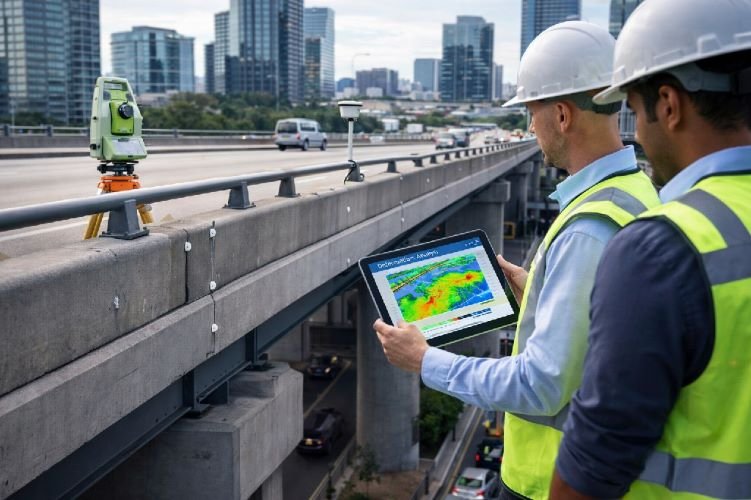
Infrastructure Deformation Monitoring with InSAR
Protect critical urban infrastructure with millimeter-precision deformation monitoring using Differential Interferometric Synthetic Aperture Radar (DInSAR). Our structural health monitoring service tracks movement and deformation in bridges, buildings, roads, tunnels, and other critical infrastructure assets across your city.
This advanced monitoring solution detects subsidence, settlement, and structural stress before they become safety hazards or require costly emergency repairs. Essential for aging infrastructure management and preventive maintenance programs in modern cities, our service provides continuous surveillance with historical baseline data for comprehensive asset management.
Key Benefits
- 1-2mm precision deformation detection
- Continuous monitoring of critical infrastructure
- Early warning prevents catastrophic failures
- $4.29B market growing to $7.18B by 2035
- Reduces maintenance costs and extends asset life
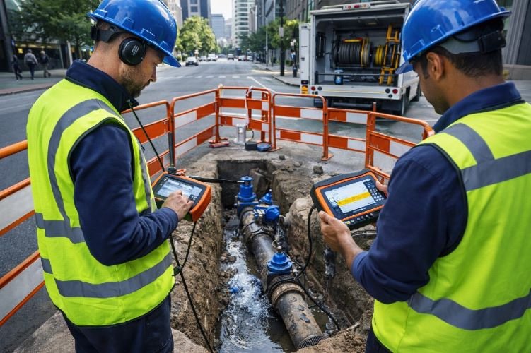
Satellite-Based Water Leak Detection
Combat water loss with our advanced water leak detection service using SAR (Synthetic Aperture Radar), thermal imaging, and AI/ML algorithms to detect subsurface moisture anomalies and pipeline leaks across urban water distribution networks. With 40% of global water lost to leaks, this technology is critical for water conservation and infrastructure management.
Our satellite-based solution identifies leak locations without excavation, dramatically reducing the time and cost of leak detection while improving water system efficiency. This service supports smart city water management initiatives, reduces non-revenue water losses, and ensures sustainable urban water supply for growing populations.
Key Benefits
- Detects underground leaks without excavation
- Addresses 40% global water loss problem
- 50,000 monthly searches with $349 CPC value
- Reduces non-revenue water losses significantly
- Critical for sustainable urban water management
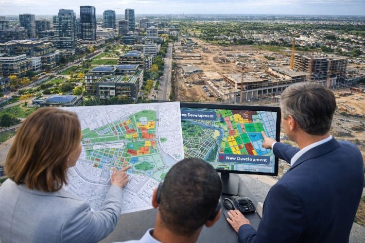
Urban Planning & City Expansion Analysis
Support strategic urban planning and city planning decisions with comprehensive satellite-based expansion analysis. Using high-resolution optical imagery, AI-powered change detection, and time-series analysis, we track urban development patterns, land use changes, and city growth dynamics to inform sustainable planning strategies.
Our land use planning and spatial planning service provides city planners with objective data on development trends, population density patterns, and infrastructure expansion needs. Essential for managing rapid urbanization, our analysis supports zoning decisions, infrastructure investment planning, and sustainable city growth aligned with smart city solutions frameworks.
Key Benefits
- Track urban growth and development patterns
- 50,000 monthly searches for urban planning terms
- Smart Cities market: $1.67T → $4.04T by 2030
- Supports sustainable city expansion strategies
- Objective data for zoning and infrastructure planning
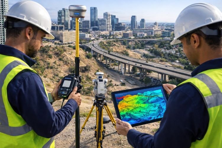
LiDAR Satellite Imagery for Infrastructure Planning
Accelerate infrastructure planning with precision LiDAR mapping, LiDAR data, and LiDAR surveying services. Our LiDAR technology generates high-accuracy 3D city models, digital elevation models, and terrain analysis for roads, utilities, drainage systems, and building development across complex urban environments.
This topographic mapping service provides the foundation for engineering design, flood risk assessment, and infrastructure routing. Our satellite-based LiDAR solutions deliver city-wide coverage more efficiently than traditional aerial surveys, supporting model 3d city development and comprehensive urban planning initiatives.
Key Benefits
- Precision 3D terrain models for city planning
- 5,000 monthly searches across LiDAR terms
- Supports infrastructure design and routing
- Faster and more cost-effective than aerial LiDAR
- Essential for flood modeling and drainage planning
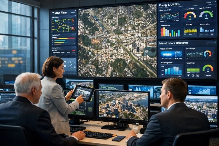
Satellite Data for Smart City Planning
Transform city management with integrated satellite mapping and multi-source data analytics platforms. Our smart city solutions combine optical imagery, SAR data, thermal sensors, and geographic information systems (GIS) to provide comprehensive urban intelligence for data-driven decision making.
This platform delivers real-time and historical data on urban systems including transportation networks, utility infrastructure, environmental conditions, and development patterns. City managers gain actionable insights for optimizing services, planning infrastructure investments, and improving citizen quality of life through evidence-based policies.
Key Benefits
- Integrated multi-source satellite data platform
- Real-time and historical urban intelligence
- Supports data-driven city management decisions
- 50,000 searches for satellite mapping services
- Foundation for comprehensive smart city initiatives
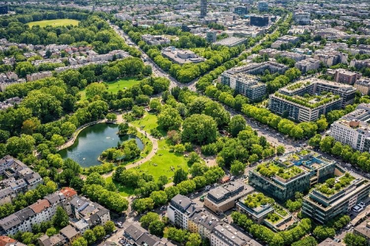
Urban Green Space Analysis Using Satellite Imagery
Optimize urban livability with comprehensive vegetation mapping and green space analysis using high resolution satellite imagery. Our service quantifies urban forestry, park distribution, tree canopy coverage, and accessibility to green spaces, supporting climate adaptation and public health initiatives.
Using NDVI (Normalized Difference Vegetation Index) and accessibility metrics, we evaluate green infrastructure quality, identify underserved neighborhoods, and track urban greening progress over time. Essential for sustainability reporting, green infrastructure planning, and addressing urban heat island effects in dense urban areas.
Key Benefits
- Quantifies urban green space distribution and access
- Supports climate adaptation and heat mitigation
- Identifies underserved areas for park development
- Critical for sustainability and livability goals
- Tracks urban greening progress over time
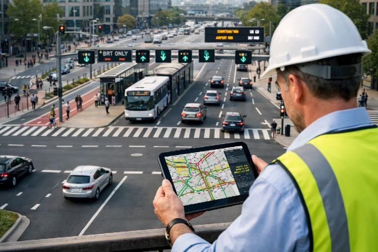
GIS & Remote Sensing for Urban Transportation Planning
Optimize urban mobility with integrated transportation planning services combining satellite data, GIS, and network analysis. Our spatial analysis platform evaluates traffic patterns, transit coverage, multimodal connectivity, and infrastructure capacity to support efficient, sustainable transportation systems.
We analyze route optimization, accessibility gaps, congestion patterns, and public transit efficiency using satellite-based change detection and GIS modeling. This service supports transit-oriented development, active transportation planning, and smart mobility initiatives aligned with sustainable urban development goals.
Key Benefits
- Comprehensive transportation network analysis
- Identifies accessibility gaps and coverage issues
- Supports multimodal and sustainable mobility
- 5,000 searches for transportation planning services
- Optimizes transit routes and infrastructure investment
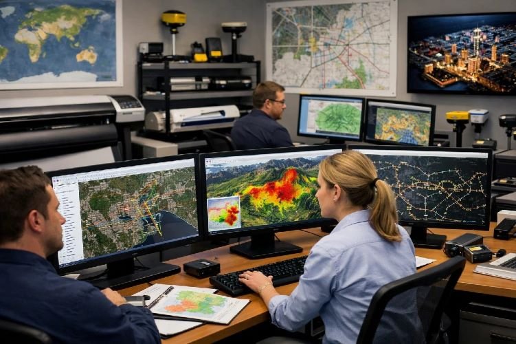
Geospatial Analysis Services
Access professional geospatial services and geospatial analysis expertise for complex urban challenges. Our comprehensive platform integrates satellite imagery, demographic data, infrastructure networks, and environmental datasets to deliver customized spatial analysis, modeling, and consulting services for city planning and management.
We provide end-to-end spatial analysis from data acquisition and processing to advanced modeling, visualization, and decision support. Our services support site selection, impact assessment, resource allocation, and strategic planning across all urban sectors including housing, utilities, environment, and economic development.
Key Benefits
- 500,000 monthly searches for geospatial services
- Comprehensive spatial data integration and analysis
- Customized solutions for complex urban challenges
- Professional GIS consulting and decision support
- Multi-sector applications across urban systems
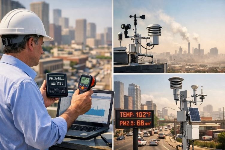
Environmental Monitoring (Air Quality + Heat Islands)
Monitor urban environmental conditions with comprehensive air quality monitoring and environmental monitoring services using multispectral and thermal satellite sensors. Track air pollution levels, identify emission sources, and map urban heat island effects to support public health protection and climate adaptation strategies.
Our environmental assessment platform provides city-wide coverage of temperature distribution, pollution hotspots, and environmental quality indicators. This data supports targeted interventions for heat mitigation, air quality improvement, and environmental justice initiatives, with regular monitoring to track progress and ensure regulatory compliance.
Key Benefits
- 50,000 searches each for air quality and heat island monitoring
- City-wide environmental quality surveillance
- Supports public health and climate adaptation
- Fastest growing smart city segment (19% CAGR)
- Identifies pollution hotspots and vulnerable areas
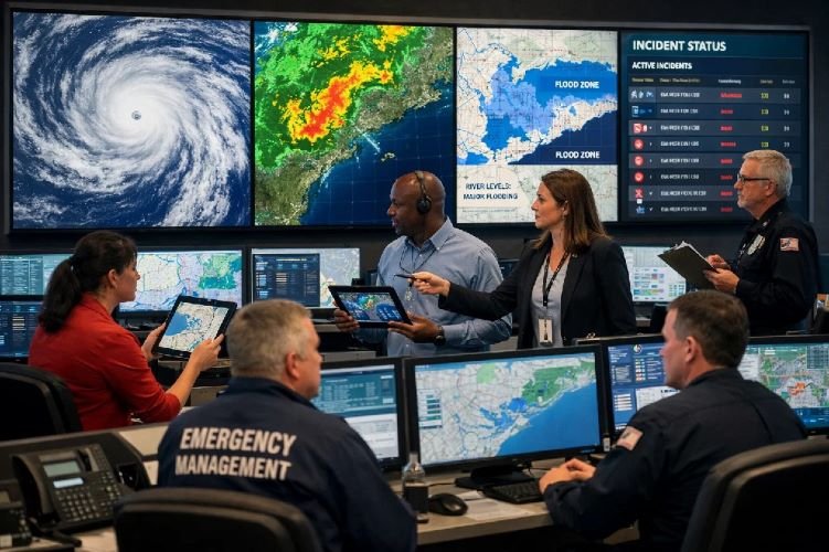
Emergency Management & Disaster Response
Enhance city resilience with rapid-response satellite monitoring for emergency management and disaster response. Our real-time SAR and optical imaging capabilities provide immediate damage assessment, flood extent mapping, and situational awareness during natural disasters, enabling faster, more effective emergency response and recovery operations.
This service delivers critical intelligence during floods, earthquakes, fires, and other urban emergencies when ground access is limited or dangerous. We provide 24/7 monitoring capability, rapid image acquisition, and automated change detection to support emergency operations centers, first responders, and recovery planning teams.
Key Benefits
- Real-time disaster monitoring and damage assessment
- $105B global disaster management market
- Rapid response when ground access is limited
- Supports emergency operations and recovery planning
- 24/7 monitoring capability for urban resilience
Why Choose Satellite-Based Smart City Solutions?
Comprehensive Urban Intelligence
Satellite technology provides city-wide coverage and consistent data across all urban systems—infrastructure, environment, transportation, and development—enabling holistic planning and management impossible with ground-based methods alone.
Data-Driven Decision Making
Replace assumptions with evidence. Our geospatial services deliver objective, quantifiable data for urban planning, infrastructure investment, environmental management, and policy development, improving outcomes and reducing risks.
Sustainable & Resilient Cities
Support climate adaptation, resource conservation, and quality of life improvements. Our smart city solutions help cities reduce water loss, improve air quality, optimize green space, and enhance emergency preparedness for a sustainable urban future.
Ready to Build a Smarter, More Sustainable City?
Join leading cities worldwide using satellite technology and geospatial services to improve urban planning, infrastructure management, and quality of life for citizens.
Contact Us Today