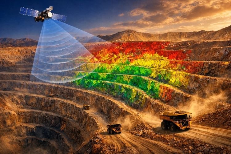
Methane Detection Technology: How Satellites Are Revolutionizing Emissions Compliance
The oil and gas industry faces an unprecedented compliance challenge in 2026. With the EPA Waste Emissions Charge now reaching $1,500 per metric ton for excess methane emissions and the European Union requiring verified emissions monitoring for all energy imports, operators can no longer rely on periodic inspections and estimated inventories. Methane detection technology based on satellite remote sensing has emerged as the definitive solution for companies seeking to meet regulatory requirements, avoid substantial financial penalties, and demonstrate genuine ESG commitment.
This comprehensive guide examines how satellite methane detection works, compares it against traditional monitoring methods, analyzes the current regulatory landscape, and provides actionable guidance for integrating these technologies into your operations. Whether you manage pipeline networks, production facilities, or midstream infrastructure, understanding these capabilities is now essential for maintaining market access and operational viability.
Why Methane Detection Technology Matters in 2026
The Climate Impact of Methane Emissions
Methane is the second-largest contributor to climate change after carbon dioxide, responsible for approximately 30% of global warming since the Industrial Revolution. However, its climate impact is disproportionate to its atmospheric concentration. Over a 20-year period, methane traps more than 80 times as much heat as an equivalent mass of carbon dioxide, making it an exceptionally potent greenhouse gas that demands immediate attention from regulators and industry alike.
The Oil and Gas Sector’s Role
The oil and gas sector represents approximately 40% of anthropogenic methane emissions globally. These emissions stem from intentional venting, incomplete flaring, equipment leaks, and fugitive releases across the production, processing, transmission, and storage value chain. What makes this particularly significant for industry is the concentration of emissions among relatively few sources.
Research conducted by NASA’s Jet Propulsion Laboratory found that fewer than 0.2% of oil and gas facilities accounted for more than one-third of California’s total methane emissions from the sector. These high-emitting facilities, classified as super-emitters, represent both the greatest challenge and the greatest opportunity for rapid emissions reduction.
Why Traditional Monitoring Falls Short
A 2025 study published in Science using GHGSat constellation data found that oil and gas facilities were actively emitting above detection thresholds approximately 16% of the time they were observed, indicating the intermittent nature of many emission events. This intermittency explains why traditional periodic inspections often miss significant emission sources. A quarterly inspection has only a small probability of coinciding with an intermittent emission event, while satellites observing the same location multiple times per week can capture these transient but significant releases.
The Global Methane Pledge, launched at COP26 and now endorsed by more than 150 countries, commits signatories to reducing methane emissions by at least 30% from 2020 levels by 2030. Achieving this target requires measurement capabilities that can identify sources, quantify emissions, and verify reductions at scales ranging from individual facilities to entire production basins.
The Regulatory Landscape Driving Satellite Adoption
EPA Waste Emissions Charge
The Inflation Reduction Act established a Waste Emissions Charge (WEC) that applies to facilities reporting more than 25,000 metric tons of CO2 equivalent annually under the Greenhouse Gas Reporting Program. The charge escalates over three years: $900 per metric ton for 2024 emissions, $1,200 for 2025, and $1,500 for 2026 and beyond. This fee applies only to emissions exceeding specific intensity thresholds established by Congress.
For upstream production, the threshold is 0.20% of natural gas sent to sale. For gathering and boosting, the threshold is 0.11% of throughput. For processing, the threshold drops to 0.05%. A facility exceeding its threshold by even modest amounts faces substantial financial exposure. For example, an upstream facility emitting 3,000 metric tons of methane with a threshold-based allowance of approximately 2,300 tons would face charges exceeding $1 million annually at the 2026 rate.
EPA Super Emitter Response Program
The OOOOb/OOOOc regulations finalized in 2024 established the Super Emitter Response Program (SERP), which creates an official mechanism for certified third parties to detect and report large emission events. A super-emitter event is defined as emissions of 100 kilograms per hour or greater of methane. Third-party organizations using EPA-approved remote sensing technologies, including satellite methane detection systems, can identify these events and report them directly to EPA.
Upon receiving notification, operators must investigate the alleged super-emitter event within five days and report investigation results to EPA within 15 days. This creates a compliance obligation that extends beyond scheduled inspections to continuous exposure whenever certified monitoring systems are observing your facilities.
European Union Methane Regulation
The EU Methane Regulation 2024/1787, which entered into force in August 2024, establishes the first import-related requirements for methane emissions globally. The regulation creates a phased implementation that will affect all companies exporting oil, gas, or coal to European markets.
By May 2025, EU importers must report information about their suppliers’ monitoring and mitigation practices. From January 2027, all new supply contracts must demonstrate that production is subject to monitoring, reporting, and verification measures equivalent to EU requirements. By August 2028, importers must report the methane intensity of their imports. The European Commission will establish a methane transparency database by February 2026 and is developing a super-emitter rapid alert mechanism using satellite data.
For U.S. producers, this means that continued access to European markets will require demonstrable measurement-based emissions reporting rather than estimated inventories.
2026 Regulatory Timeline: Key Compliance Milestones
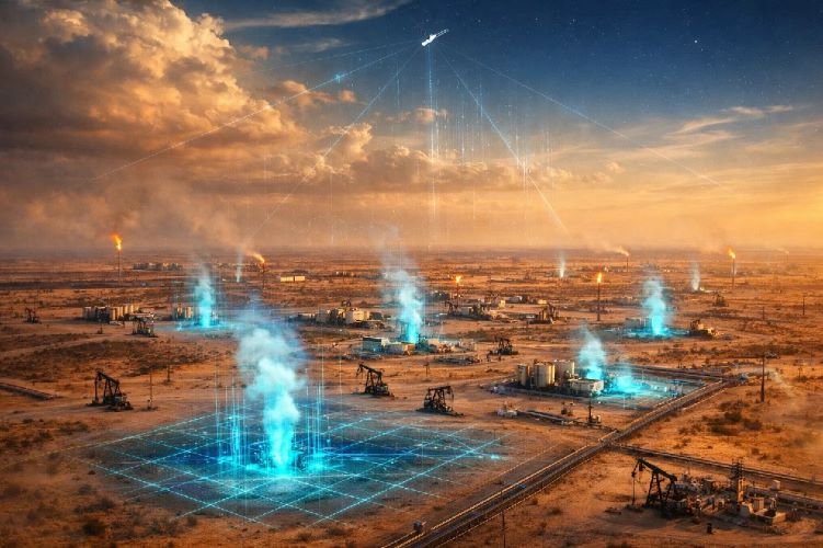
How Satellite Methane Detection Technology Works
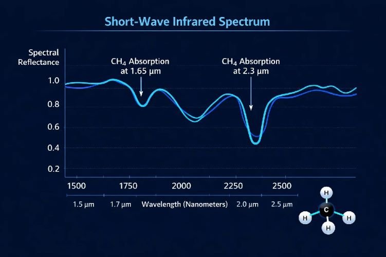
The Physics of Detection
Satellite methane detection relies on a fundamental principle of atmospheric physics: methane molecules absorb light at specific wavelengths in the Short-Wave Infrared (SWIR) region of the electromagnetic spectrum. When sunlight passes through the atmosphere and reflects off Earth’s surface, methane in the atmospheric column absorbs a portion of that light at characteristic wavelengths, primarily around 1.65 micrometers and 2.3 micrometers.
Hyperspectral imaging sensors aboard satellites measure this absorption by comparing reflected light intensity across many narrow spectral bands. By analyzing the depth and shape of absorption features, specialized algorithms calculate the total column concentration of methane between the satellite and the surface. When a localized emission source creates an enhanced concentration plume, this appears as an anomaly against the background atmospheric methane level.
Detection Capabilities and Sensor Types
The detection capabilities of different satellite systems vary based on their spectral and spatial resolution. High-resolution hyperspectral imaging sensors like those on GHGSat satellites achieve spectral resolution of 0.3 nanometers and spatial resolution of 25 meters, enabling detection of emission sources as small as 100 kilograms per hour under favorable conditions. This precision allows attribution of emissions to specific pieces of equipment within a facility.
Moderate-resolution hyperspectral sensors like PRISMA and EnMAP offer 10-nanometer spectral resolution at 30-meter spatial resolution. These systems can detect larger plumes and are particularly useful for regional surveys and confirming emissions from known facilities.
Multispectral sensors like Sentinel-2, while not designed specifically for methane detection, have demonstrated capability for detecting very large emission events by comparing reflectance between their SWIR sensors bands. Their global coverage every two to five days and extensive historical archives make them valuable for identifying persistent super-emitters and tracking emissions over time.
Processing and Quantification
Processing satellite data to extract methane concentrations requires sophisticated algorithms. Traditional approaches use radiative transfer models that account for atmospheric conditions, surface reflectance, and viewing geometry. More recently, machine learning approaches including Vision Transformers and convolutional neural networks have demonstrated improved detection capability, with some models achieving detection of plumes as small as 200 to 300 kilograms per hour from Sentinel-2 multispectral data.
Methane quantification from detected plumes requires additional analysis. The Integrated Mass Enhancement method calculates total methane mass within a plume and combines this with wind speed data to estimate source emission rates. However, uncertainty in wind speed and direction contributes significant error to these estimates, typically ranging from 15% to 65% depending on conditions and methodology.
Satellite vs. Traditional Methane Detection Methods
How Traditional LDAR Programs Work
Traditional LDAR programs have relied primarily on two technologies: handheld Optical Gas Imaging (OGI) cameras and EPA Method 21 portable analyzers.
Optical Gas Imaging cameras operate in the mid-wave infrared spectrum, typically 3 to 5 micrometers, where methane exhibits strong absorption. These cameras visualize gas emissions as visible plumes against the thermal background, allowing trained operators to identify leak sources during facility walkthroughs. The technology provides direct visualization and precise source identification, making it valuable for repair planning.
However, OGI effectiveness depends heavily on operator experience. A study conducted at Colorado State University’s METEC facility found that experienced surveyors with more than 700 surveys achieved 90% detection probability at emission rates of approximately 7 standard cubic feet per hour. Less experienced surveyors did not achieve 90% detection even at rates exceeding 20 standard cubic feet per hour. This represents detection rates an order of magnitude lower than controlled laboratory studies of camera performance, highlighting the gap between theoretical capability and field effectiveness.
Method 21 analyzers measure hydrocarbon concentration at individual components using a probe. While highly accurate for quantifying leaks at specific points, the method requires physical access to each component and cannot efficiently survey facilities with thousands of potential leak sources.
The Advantages of Satellite Monitoring
Satellite methane detection complements traditional methods by providing capabilities that ground and aerial approaches cannot match. Satellites observe the same location repeatedly without requiring physical access, flight approvals, or on-site personnel. This enables detection of intermittent emissions that periodic surveys miss.
The GHGSat study finding that oil and gas facilities emit above detection thresholds only 16% of the time they are observed demonstrates why continuous monitoring matters. A facility inspected quarterly has only a 16% chance of catching an active emission event during any given inspection. A satellite constellation observing the same facility weekly has multiple opportunities to detect intermittent releases over time.
The Tiered Monitoring Approach
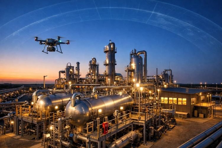
The most effective emissions monitoring programs implement a tiered approach that leverages the strengths of each technology. Satellites provide continuous wide-area surveillance and identify facilities requiring attention. Aircraft or drones confirm and further characterize detected emissions. Ground-based OGI pinpoints specific leak sources for repair. This integrated approach combines the coverage of remote sensing with the precision of direct observation.
Leading Satellite Platforms for Methane Detection
GHGSat: The Commercial Leader
GHGSat operates the largest commercial constellation dedicated to greenhouse gas monitoring, with 16 satellites in orbit as of late 2025. The company’s proprietary Fabry-Pérot imaging spectrometers achieve 25-meter spatial resolution with spectral resolution of 0.3 nanometers in the 1630 to 1675 nanometer range. This configuration enables detection thresholds as low as 100 kilograms per hour under favorable conditions.
In 2024 alone, GHGSat satellites observed more than 4 million industrial facilities across 110 countries, detecting over 20,000 emission events equivalent to 534 million metric tons of CO2 equivalent. The company’s clients include major operators such as ExxonMobil, Aramco, and various government agencies seeking independent verification of their emissions performance.

Carbon Mapper and Tanager-1
Carbon Mapper, a nonprofit coalition including NASA’s Jet Propulsion Laboratory, launched its Tanager-1 satellite in August 2024. The organization’s mission focuses on making methane and CO2 data publicly accessible to support direct mitigation action. Carbon Mapper’s data portal provides observations of super-emitters globally, with particular focus on enabling accountability for large emission sources that might otherwise escape detection.
MethaneSAT Legacy
MethaneSAT, developed by the Environmental Defense Fund, operated from March 2024 until June 2025 when contact with the satellite was lost. During its operational period, the mission provided unique capabilities for measuring emissions across entire production basins with 100-meter by 400-meter spatial resolution and precision of 2 parts per billion. MethaneSAT data revealed that dispersed sources emitting less than 500 kilograms per hour account for a significant portion of total basin emissions, complementing point-source detections from higher-resolution instruments.
UNEP Methane Alert and Response System
The United Nations Environment Programme operates the Methane Alert and Response System (MARS), which uses data from more than a dozen satellite instruments to identify and notify governments and companies of large emission events. MARS notifications have already led to verified emissions reductions across four continents, demonstrating the operational effectiveness of satellite-based detection for driving mitigation action at the global scale.
Leading Satellite Platforms Comparison
100 kg/hr threshold
Commercial service
~200 kg/hr threshold
Public data access
Regional hotspots
Free ESA data
Government alerts
Global coverage
Real-World Results and Case Studies
UK Pipeline Detection: Wales & West Utilities
In the United Kingdom, GHGSat detected a methane leak from a damaged pipeline operated by Wales & West Utilities. This marked the first space-facilitated methane detection and mitigation effort in the UK. The company repaired the leak based on satellite notification, preventing emissions equivalent to the annual electricity consumption of over 7,500 homes. This case demonstrated the viability of satellite monitoring for pipeline infrastructure in addition to production facilities.
California Satellite Methane Project
California’s Satellite Methane Project represents the first major government initiative using satellite methane detection in a non-research operational context. The California Air Resources Board partnered with Carbon Mapper to monitor oil and gas facilities and landfills statewide. Within months of operation, the project identified and enabled repair of 10 large leaks. In one case, a gas field leak in Kern County was detected by satellite and repaired within 24 hours, demonstrating rapid response capability enabled by near-real-time monitoring.
Permian Basin Revelations
MethaneSAT data from the Permian Basin revealed emission rates far exceeding industry-reported values, with some areas showing leak rates up to 45 times higher than regulatory limits. The data showed that both super-emitters and smaller dispersed sources contribute significantly to total basin emissions, indicating that comprehensive monitoring programs must address the full range of emission sizes.
PEMEX Transparency Case
In Mexico, satellite observations from Carbon Mapper and Kayrros documented continued methane emissions from PEMEX operations despite corporate commitments to reduce flaring. In April 2024, sensors detected a plume releasing more than 16 tonnes of methane per hour from the Cosoleacaque complex, a rate higher than any single plume detected in the United States or Venezuela that year. This third-party satellite data created financial and political pressure for the state oil company to address its emissions practices.
Global Science Study Results
A comprehensive 2025 study published in Science used GHGSat constellation data to estimate global energy sector methane emissions at facility scale. The analysis detected 8.3 million tonnes of methane emissions from 3,114 sites worldwide during 2023. Coal mining facilities showed the highest emission persistence, leaking above detection thresholds 48% of the time observed, compared to 16% for oil and gas facilities. This finding highlights the intermittent nature of oil and gas emissions and explains why continuous monitoring detects sources that periodic surveys miss.
Ready to Implement Satellite Methane Monitoring?
SkyIntelGroup provides comprehensive emissions monitoring solutions tailored to oil and gas operations.
Our team combines expertise in hyperspectral imaging analysis with deep understanding of EPA, EU, and international regulatory requirements. We help operators establish baseline measurements, implement tiered monitoring programs, and document compliance for market access.
The Financial Case for Satellite Methane Detection
Waste Emissions Charge Avoidance
The most direct financial benefit comes from avoiding the EPA Waste Emissions Charge. At $1,500 per metric ton in 2026, even modest emission reductions generate substantial savings. A facility reducing excess emissions by 500 tonnes annually avoids $750,000 in charges. Early detection and repair of super-emitter events prevents the accumulation of emissions that would otherwise contribute to annual totals.
Revenue Protection Through Captured Methane
Natural gas that escapes as fugitive emissions represents lost product. At current natural gas prices, large emission sources represent significant annual value that could instead flow to sales. Identifying and repairing leaks that satellites detect converts compliance costs into revenue recovery.
Operational Efficiency Gains
Operational efficiency improves when satellite monitoring replaces or supplements traditional patrol methods. Ground-based pipeline patrols cost up to $619 per kilometer annually. Helicopter overflights carry substantial hourly operating costs and are limited by weather and crew availability. Satellite monitoring covers entire networks continuously at subscription costs that often compare favorably to traditional inspection programs, particularly for operators with extensive or remote infrastructure.
Market Access and EU Compliance
Market access represents perhaps the largest long-term financial consideration. EU import requirements will effectively create a market barrier for producers unable to demonstrate measurement-based emissions performance. Companies establishing emissions monitoring capabilities now position themselves for continued access to European markets while competitors without such capabilities may face exclusion or price penalties beginning in 2027.
Limitations and Considerations
Technical Challenges
Detection thresholds vary based on sensor characteristics, atmospheric conditions, surface properties, and viewing geometry. Even the highest-resolution commercial systems typically require emission rates of 100 kilograms per hour or greater for reliable detection under favorable conditions. Smaller leaks that individually fall below detection thresholds may still contribute substantially to total facility emissions.
Cloud cover obstructs optical and hyperspectral imaging sensors, creating gaps in observation records for regions with persistent cloud cover. While Synthetic Aperture Radar can penetrate clouds, SAR is not currently used for methane detection. Operators in frequently cloudy regions may experience longer intervals between usable observations.
Quantification Uncertainty
Quantification accuracy depends heavily on wind speed and direction, which must be estimated from meteorological models rather than measured at the emission source. Studies have documented quantification uncertainties ranging from 15% to over 65% depending on conditions and methodology. This uncertainty affects the precision of emission rate estimates but does not prevent detection of significant sources.
The Solution: Tiered Integration
These limitations argue for a tiered monitoring approach rather than reliance on any single technology. Satellites provide continuous surveillance and detection of significant emission events. Aircraft and drones offer flexible intermediate-scale monitoring for confirmation and characterization. Ground-based methods provide the precision needed for repair planning and verification. The integrated approach leverages the strengths of each technology while compensating for individual limitations.
Frequently Asked Questions About Methane Detection Technology
What is the detection threshold for satellite methane monitoring?
Detection thresholds vary by satellite system and observing conditions. High-resolution commercial systems like GHGSat can detect emissions as low as 100 kilograms per hour under favorable conditions, equivalent to approximately 2.4 metric tons per day. This threshold aligns with the EPA’s definition of a super-emitter event, making satellite detection directly relevant to SERP compliance obligations. Moderate-resolution systems typically require 300 to 500 kilograms per hour for reliable detection. Very large super-emitter events exceeding several tonnes per hour can be detected by multispectral sensors not specifically designed for methane observation, including Sentinel-2 and even some weather satellites. The detection threshold also depends on surface characteristics, with homogeneous surfaces like desert or agricultural land providing better contrast than heterogeneous urban or mountainous terrain.
How often can satellites monitor the same location?
Revisit frequency depends on constellation size and orbital parameters. GHGSat with 16 satellites can provide daily revisit capability for priority locations, though actual observation frequency depends on tasking priorities and atmospheric conditions. Single-satellite systems like PRISMA offer revisit times of approximately seven days with pointing capability. Sentinel-2’s twin satellites provide global coverage every two to five days at no cost, though with limited methane detection capability. For compliance purposes, the frequency of observations matters because it determines the probability of capturing intermittent emission events. Given that oil and gas facilities emit above detection thresholds only 16% of observation times according to GHGSat research, weekly monitoring over several months provides much higher cumulative detection probability than quarterly ground inspections.
What is a super-emitter event under EPA regulations?
EPA defines a super-emitter event as emissions of 100 kilograms per hour or greater of methane from an oil and natural gas facility. This threshold equals approximately 220 pounds per hour or 2.4 metric tons per day. Super-emitter events may result from equipment malfunctions, operational venting, incomplete combustion at flares, stuck valves, open hatches, or other causes. Detection of such events by certified third parties using EPA-approved remote sensing technologies triggers mandatory operator obligations. Operators must investigate the alleged super-emitter event within five calendar days of receiving EPA notification. Investigation results must be reported to EPA within 15 calendar days. If the investigation confirms a super-emitter event occurred, the operator must take corrective action and document the repair. Third-party notifiers must meet EPA certification requirements and use approved detection methodologies.
Can satellite data be used for EPA compliance reporting?
Satellite data supports compliance in multiple ways under current regulations. Under the Super Emitter Response Program established by OOOOb/OOOOc rules, certified third parties using EPA-approved satellite technology can report detected super-emitter events directly to EPA, triggering operator investigation requirements. For Subpart W greenhouse gas reporting, satellite data can validate or supplement reported emissions and may identify discrepancies between reported and actual emission levels. However, satellite monitoring does not currently substitute for required LDAR programs under OOOOb/OOOOc regulations, which specify permitted detection methods including OGI cameras. The regulatory landscape continues to evolve, with increasing acceptance of alternative monitoring technologies. The PHMSA Direct Final Rule of July 2025 recognized satellite imaging as an equivalent method for pipeline right-of-way patrols, though this rule was subsequently withdrawn pending further rulemaking. Additional regulatory guidance on satellite monitoring acceptance is expected through 2026 and 2027.
How does satellite methane detection compare to traditional OGI?
Satellite and OGI technologies serve complementary roles rather than competing as alternatives. Satellites provide continuous wide-area coverage without physical access, detecting significant emission events across entire facility portfolios simultaneously. This enables identification of intermittent emissions that periodic OGI surveys miss. However, satellite detection thresholds (typically 100+ kg/hr) mean smaller leaks escape detection from orbit. OGI cameras provide direct visualization and precise source localization during on-site surveys, with detection thresholds an order of magnitude lower than satellites. Experienced OGI operators can identify leaks as small as a few kilograms per hour and pinpoint their exact location for repair. The limitation is that OGI surveys occur periodically rather than continuously. Effective programs integrate both technologies in a tiered approach: satellites for surveillance and prioritization, followed by ground-based OGI for detailed characterization and repair planning at facilities flagged by satellite observations.
What does satellite methane monitoring cost?
Commercial satellite monitoring services typically operate on subscription models with pricing varying by coverage area, observation frequency, and service level. Annual subscriptions for portfolio-level monitoring may range from tens of thousands to hundreds of thousands of dollars depending on the number of facilities and desired revisit frequency. Per-observation tasking for specific facilities typically costs less than aerial surveys covering equivalent areas. Some providers offer tiered service levels ranging from basic detection alerts to comprehensive analytics, integration with operational systems, and regulatory reporting support. For operators subject to the Waste Emissions Charge, the return on investment calculation is straightforward: monitoring costs are justified if they enable emissions reductions worth more than the subscription fee at $1,500 per metric ton. A monitoring program costing $100,000 annually pays for itself by preventing just 67 tonnes of excess emissions from being charged. Given that single super-emitter events can release hundreds or thousands of tonnes over their duration if undetected, the financial case for monitoring is compelling for most operators.
Take Control of Your Methane Emissions
The convergence of regulatory pressure, financial penalties, and advancing technology has made methane detection technology an operational necessity rather than an optional enhancement. With the EPA Waste Emissions Charge reaching $1,500 per metric ton in 2026, EU import requirements taking effect, and third-party satellite monitoring creating unprecedented transparency, operators who delay implementation face escalating costs and competitive disadvantage.
SkyIntelGroup provides comprehensive satellite-based emissions monitoring services tailored to the oil and gas sector. Our team combines expertise in hyperspectral imaging analysis with deep understanding of regulatory requirements to deliver actionable intelligence that supports compliance, reduces liability, and protects market access.
Start Your Methane Monitoring Program Today
Contact our specialists to discuss your monitoring requirements, regulatory obligations, and implementation timeline.