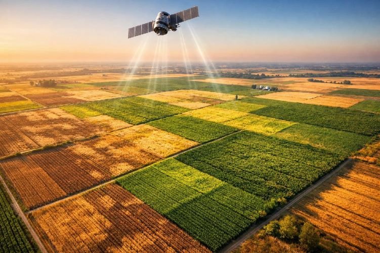
Remote Sensing in Agriculture: Applications, Technologies & 2026 Advances
The global remote sensing in agriculture market has crossed $6 billion in 2025 and continues accelerating at 14.7% annually. From detecting crop stress two weeks before visible symptoms appear to optimizing irrigation schedules that save 30% water consumption, satellite imagery for agriculture has become the backbone of modern farm management technology.
This transformation matters because agriculture faces unprecedented pressure. Global population growth demands higher yields from the same land, climate volatility introduces new risks every season, and sustainability requirements from regulators and consumers require documented proof of responsible practices. Traditional field scouting cannot scale to meet these challenges. Precision agriculture powered by satellite crop monitoring can.
For agribusiness executives, farm managers, and agricultural consultants evaluating how to integrate satellite intelligence into their operations, understanding the full spectrum of applications, technologies, and implementation approaches is essential. This guide covers everything from foundational concepts to advanced agricultural remote sensing applications, with quantified ROI data and practical guidance on getting started.
What Is Remote Sensing in Agriculture?
Remote sensing refers to acquiring information about crops, soil, and environmental conditions without physical contact, using sensors mounted on satellites, aircraft, or drones. In agriculture, this technology captures electromagnetic radiation reflected or emitted from fields across multiple spectral bands, revealing information invisible to the human eye.
The core principle is straightforward: healthy vegetation reflects near-infrared light strongly while absorbing red light for photosynthesis. Stressed crops show different reflectance patterns. By measuring these spectral signatures across millions of data points, precision farming solutions generate actionable intelligence about crop health, water status, nutrient deficiencies, and disease presence.
How Satellite Crop Monitoring Works
Modern satellite crop monitoring operates through a continuous cycle of data acquisition, processing, and analysis. Satellites orbiting Earth capture imagery of agricultural areas at regular intervals, ranging from daily coverage with commercial constellations to every five days with free Sentinel-2 data. This imagery travels to ground stations where specialized software processes raw data into calibrated, georeferenced products.
The processed imagery then undergoes analysis to extract meaningful agricultural indicators. Vegetation indices like NDVI quantify plant vigor. Thermal bands reveal water stress. Radar penetrates clouds to monitor soil moisture regardless of weather conditions. Machine learning algorithms increasingly automate the interpretation process, flagging anomalies and generating alerts when intervention is needed.
For agricultural operations, this translates to near-real-time visibility across entire holdings without deploying personnel to every field. A farm manager overseeing 50,000 hectares can identify the specific 200-hectare block experiencing irrigation problems within minutes rather than days.
Key Technologies: Multispectral, SAR, Thermal, and Hyperspectral
Four primary sensor technologies power remote sensing in agriculture, each capturing different information:
Multispectral imaging remains the workhorse of agricultural remote sensing applications. Sensors capture data in 4-12 spectral bands, typically including visible light (red, green, blue), near-infrared, and shortwave infrared. This enables calculation of vegetation indices that quantify crop monitoring status, biomass, and chlorophyll content. Sentinel-2 provides free multispectral imagery at 10-20 meter resolution with global coverage every five days.
Synthetic Aperture Radar (SAR) transmits microwave pulses and measures the returned signal, operating day or night and penetrating cloud cover. SAR excels at monitoring soil moisture, detecting surface roughness changes, and tracking crop structure throughout the growing season. For regions with frequent cloud cover, SAR provides the only reliable source of continuous monitoring data.
Thermal infrared sensors measure heat emission from crop canopies, directly indicating water stress and evapotranspiration rates. When plants close stomata due to water deficit, leaf temperature rises. Thermal monitoring detects this stress response before visible wilting occurs, enabling proactive irrigation management.
Hyperspectral imaging captures data across 50-250+ narrow spectral bands, creating detailed spectral signatures for each pixel. This technology identifies specific crop diseases, detects nutrient deficiencies at the elemental level, and differentiates between crop varieties. The hyperspectral market in agriculture is projected to exceed $400 million globally, driven by demand for increasingly precise diagnostics.
Satellite Platforms Powering Agricultural Intelligence
Understanding available satellite platforms helps agricultural operations evaluate data options and provider capabilities. The constellation of Earth observation satellites has expanded dramatically, with over 1,200 active remote sensing satellites as of 2024.
Free data from Copernicus (Sentinel) and USGS (Landsat) programs democratizes access to agricultural remote sensing applications. Commercial providers like Planet offer higher resolution and more frequent revisits for operations requiring daily monitoring or sub-field precision.
The choice of platform depends on specific application requirements. Broad-acre crop monitoring works effectively with 10-20 meter Sentinel-2 data. High-value crops or complex field patterns may justify commercial imagery investment. SAR platforms become essential in cloud-prone regions or for applications like soil moisture and DInSAR subsidence monitoring.
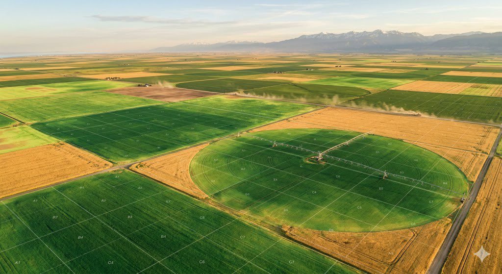
10 High-Impact Applications of Remote Sensing in Agriculture
The practical applications of satellite imagery for agriculture span the entire crop production cycle, from pre-planting assessment through post-harvest analysis. Each application addresses specific operational challenges while contributing to overall farm profitability and sustainability.
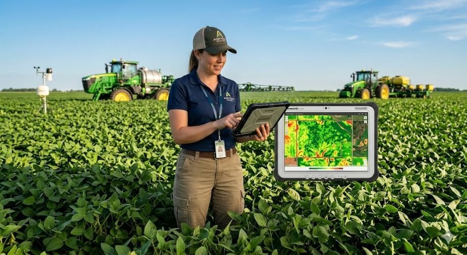
Crop Health Monitoring with NDVI Analysis
The Normalized Difference Vegetation Index (NDVI analysis) remains the most widely adopted application of remote sensing in agriculture. By comparing near-infrared and red light reflectance, NDVI quantifies photosynthetic activity and overall plant vigor on a scale from -1 to +1, where higher values indicate healthier vegetation.
Regular NDVI monitoring across growing seasons enables early detection of stress zones before problems become visible. Research confirms that satellites can detect crop stress up to two weeks before the human eye perceives any symptoms. This early warning window allows targeted intervention, whether adjusting irrigation, applying corrective fertilization, or investigating pest pressure.
Yield Prediction and Forecasting
Crop yield prediction using satellite data has matured from experimental research to operational capability. Machine learning models combining vegetation indices, weather data, soil information, and historical yield records now achieve R² values between 0.4 and 0.88 depending on crop type and data availability. AI-based yield prediction models have improved forecast accuracy by approximately 25% since 2023.
Accurate yield forecasting one month or more before harvest transforms agricultural planning. Commodity traders hedge positions based on satellite-derived production estimates. Food companies secure supply contracts with greater confidence. For operations managing diverse crop portfolios across multiple regions, aggregated yield intelligence from satellite monitoring services provides strategic visibility that ground-based assessment cannot match at scale.
Variable Rate Application Mapping
Variable rate application (VRA) technology applies fertilizers, pesticides, and seeds at varying rates across a field based on localized needs rather than uniform field-wide rates. Remote sensing provides the prescription maps that guide VRA equipment, translating satellite-derived vegetation indices and soil data into actionable application zones.
The economic impact is substantial. Research consistently demonstrates 15-30% reduction in fertilizer, pesticide, and water usage through targeted applications based on actual crop needs rather than field averages.
Ready to Optimize Your Input Applications?
Sky Intel Group delivers precision VRA maps and crop health analysis tailored to your specific fields. Reduce costs. Increase yields. Improve sustainability.
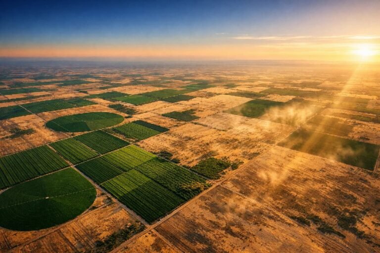
Soil Moisture and Precision Irrigation Management
Water scarcity ranks among the greatest challenges facing agriculture in 2026. Remote sensing enables assessment of soil moisture, evapotranspiration rates, and crop water stress across entire operations, providing precise guidance for precision irrigation management.
Farmers in the Mediterranean have reduced irrigation water use by 30% using satellite-based soil moisture maps that identify dry spots and overwatered areas for zone-specific irrigation scheduling. A study in China’s Hexi Corridor documented water usage reductions of 14.76% in Wuwei and 10.23% in Zhangye through remote sensing and data-driven optimization.
SAR satellites prove particularly valuable for soil moisture monitoring, as radar backscatter correlates with surface moisture content. Combined with thermal imagery showing canopy temperature variations, integrated analysis reveals both current moisture status and developing stress conditions.
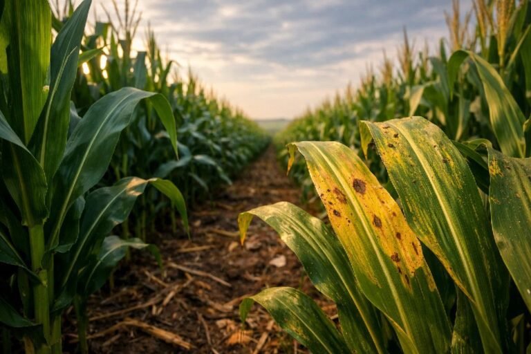
Disease and Pest Early Detection
Crop diseases and pest infestations cause billions in annual losses, but early detection enables targeted intervention before widespread damage occurs. Precision agriculture remote sensing identifies spectral anomalies associated with pathogen infection or insect feeding damage, often before symptoms become visible to field scouts.
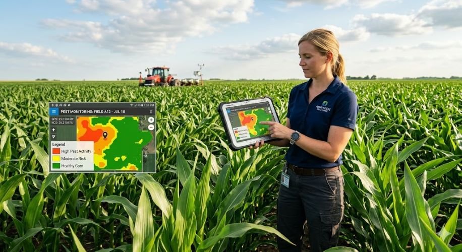
Multispectral analysis reveals changes in chlorophyll content, cell structure, and water status that accompany disease progression. Hyperspectral sensors provide even greater specificity, with research demonstrating identification of specific pathogens based on unique spectral signatures.
Drought Monitoring and Water Stress Detection
Climate volatility increases drought frequency and severity across agricultural regions globally. Satellite-based drought monitoring combines multiple indicators including vegetation condition indices, soil moisture estimates, and precipitation anomalies to assess water stress at field to regional scales.
Early drought detection through remote sensing provides critical lead time for adaptive management. Irrigation scheduling adjusts to prioritize highest-value crops. Cover crop decisions account for available moisture. Insurance providers track developing conditions across their portfolio exposure.
For agricultural operations working with satellite intelligence providers, drought monitoring integrates with broader crop health surveillance, creating comprehensive risk visibility throughout growing seasons.
Field Delineation and Mapping
Accurate field boundary mapping provides the foundation for all precision farming solutions. Satellite imagery combined with AI-powered segmentation automatically delineates parcels, identifies crop types, and tracks land use changes across seasons.
Field delineation supports area verification for insurance, subsidy programs, and contract farming arrangements. Change detection reveals unauthorized land use or undeclared acreage. Historical boundary tracking documents property modifications for legal and planning purposes.
Agricultural Insurance Verification
The agricultural insurance industry has embraced remote sensing for claims verification, policy underwriting, and parametric trigger monitoring. NDVI time series analysis is now used in 77% of crop index insurance studies, providing objective documentation of vegetation conditions throughout coverage periods.
Index-based insurance products use satellite-derived indicators as payout triggers, eliminating the need for field-level loss adjustment. When NDVI drops below threshold values during critical growth stages, payments process automatically. This approach reduces basis risk while accelerating claim resolution.
Subsidence Monitoring with DInSAR
Intensive groundwater extraction for irrigation causes land subsidence in agricultural regions worldwide, threatening infrastructure, altering drainage patterns, and indicating unsustainable aquifer management. Differential Interferometric SAR (DInSAR) detects millimeter-scale ground movement through analysis of radar phase differences between satellite passes.
This capability represents a significant differentiator in agricultural remote sensing applications. While most providers focus on optical crop monitoring, DInSAR subsidence analysis addresses a critical but often overlooked issue. California’s Central Valley, India’s Punjab region, and northern China’s agricultural zones all experience measurable subsidence from irrigation water pumping.
Sky Intel Group’s DInSAR expertise provides agricultural operations with unique visibility into this subsurface challenge, supporting sustainable water resource management and infrastructure protection.
ESG Compliance and Sustainability Reporting
Environmental, Social, and Governance (ESG) requirements increasingly demand documented evidence of sustainable agricultural practices. Remote sensing provides verifiable data on water use efficiency, input application precision, land use change, and carbon sequestration.
Satellite-derived metrics support corporate sustainability reporting with objective, third-party verifiable data. Food companies trace supply chain sustainability through field-level monitoring. Carbon credit programs verify agricultural carbon sequestration through vegetation and soil analysis.
Quantifiable ROI: What the Data Shows
Investment in agricultural remote sensing applications delivers measurable returns across multiple operational dimensions. Meta-analyses of precision agriculture implementations confirm consistent economic benefits through input savings, yield improvements, and risk reduction.
A comprehensive life cycle assessment review found that overall results suggest precision agriculture utilization delivers economic benefits either via cost savings, input savings, and/or increases to yield, margin, or profits. Variable rate technology showed particular promise, with one study documenting 61% reduction in marine eutrophication impacts alongside 38% water use reduction.
For every 100-hectare increase in farm size, research indicates ROI effect sizes increase by an average of 0.4, demonstrating that larger operations capture proportionally greater benefits from precision farming solutions investments.
SaaS Platforms vs. Consultative Services: Choosing the Right Approach
The agricultural remote sensing applications market offers two distinct service models, each suited to different operational requirements and organizational capabilities.
SaaS platforms serve operations with internal technical capacity to interpret satellite data and integrate findings into decision workflows. These platforms provide cost-effective access to imagery and basic analytics but require staff time for data interpretation and action planning.
Consultative services deliver complete intelligence solutions, from satellite data acquisition through expert analysis to formatted recommendations. This approach suits operations that need actionable insights without building internal remote sensing expertise. The consultative model also enables advanced analyses like DInSAR subsidence monitoring that require specialized processing capabilities beyond typical SaaS offerings.
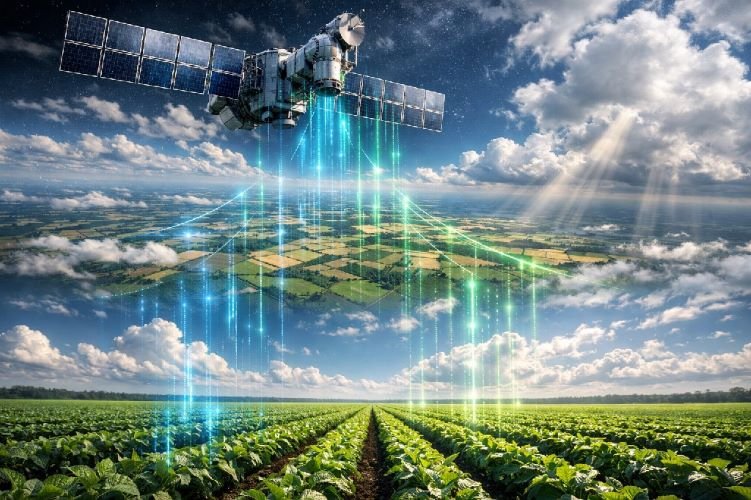
How Sky Intel Group Delivers Remote Sensing for Agriculture
Sky Intel Group provides consultative remote sensing in agriculture services that transform satellite data into operational intelligence. Rather than offering another dashboard to monitor, we deliver expert analysis and recommendations formatted for direct integration into your decision workflows.
Our agricultural services span the complete range of agricultural remote sensing applications:
Multi-sensor integration combines optical multispectral imagery with SAR radar data, thermal analysis, and specialized indices to provide comprehensive field intelligence. Where standard providers rely solely on optical data, our integrated approach delivers insights that single-sensor analysis cannot achieve.
Format-agnostic delivery means you receive intelligence in whatever format serves your operations best. Detailed PDF reports for management review. GIS shapefiles for integration with precision equipment. Data exports compatible with your existing farm management technology. We adapt to your workflows rather than forcing you into a proprietary platform.
DInSAR subsidence monitoring represents a unique capability for agricultural operations. Intensive irrigation pumping causes measurable ground subsidence in many agricultural regions, with implications for infrastructure integrity, drainage patterns, and long-term aquifer sustainability. Our millimeter-precision subsidence analysis provides visibility into this critical but often invisible issue.
Expert interpretation transforms data into decisions. Our analysts understand both the technical aspects of remote sensing and the practical realities of agricultural operations. Every deliverable includes clear recommendations for action, not just maps requiring interpretation.
Getting Started with Agricultural Remote Sensing
Implementing satellite imagery for agriculture follows a structured process that scales with operational complexity and objectives.
Initial assessment defines monitoring requirements based on crops, geography, management challenges, and decision support needs. This scoping phase ensures subsequent analysis addresses actual operational priorities rather than generic metrics.
Pilot implementation applies remote sensing analysis to a representative subset of operations, typically covering one to two growing seasons. Pilot results validate ROI assumptions, refine analysis parameters, and build internal familiarity with satellite-derived intelligence before broader rollout.
Operational scaling expands proven approaches across the full operation. At this stage, satellite crop monitoring integrates with existing management systems, from irrigation scheduling through input planning to harvest logistics.
Continuous refinement improves analysis accuracy and actionability over time. Machine learning models trained on operation-specific data increasingly automate anomaly detection and recommendation generation.
For operations ready to explore how precision agriculture remote sensing applies to their specific situation, Sky Intel Group offers initial consultations to assess requirements and outline potential approaches.
Transform Your Agricultural Operations with Satellite Intelligence
From crop health monitoring to subsidence detection, Sky Intel Group delivers comprehensive satellite intelligence tailored to your operation. No software subscriptions. No data interpretation burden. Just actionable insights.
Frequently Asked Questions
What types of crops benefit most from remote sensing monitoring?
All crop types benefit from remote sensing in agriculture, though ROI typically appears fastest with high-value crops like fruits, nuts, and vegetables where intervention timing critically affects quality and yield. Field crops including corn, soybeans, and wheat benefit through optimized input applications that accumulate significant savings at scale. Operations managing 5,000+ hectares generally see the strongest returns from satellite crop monitoring investments.
How often should agricultural fields be monitored with satellites?
Monitoring frequency depends on crop type, growth stage, and management intensity. Weekly monitoring during critical growth periods captures developing issues before they become severe. Monthly monitoring may suffice during dormant periods or for stable perennial crops. Operations in cloud-prone regions benefit from SAR integration that maintains monitoring continuity regardless of weather conditions.
Can satellite remote sensing replace ground-based field scouting?
Satellite monitoring complements rather than replaces field scouting by directing attention to areas requiring investigation. Remote sensing identifies anomalies across entire operations that scouts can then verify and diagnose on the ground. This targeted approach makes field scouting more efficient while ensuring nothing escapes detection between visits.
What is the minimum farm size for cost-effective remote sensing implementation?
Free Sentinel-2 data makes basic crop monitoring accessible to operations of any size. Commercial precision farming solutions typically become cost-effective for operations exceeding 500-1,000 hectares, where savings from optimized inputs and early problem detection exceed monitoring costs. Smaller high-value operations like orchards and vineyards may justify investment at lower acreage thresholds.
How does weather affect satellite data availability and quality?
Cloud cover prevents optical satellite imagery acquisition, creating gaps in monitoring coverage. SAR radar penetrates clouds and operates day or night, providing weather-independent monitoring capability. Integrated approaches combining optical and radar data ensure continuous coverage for operations in regions with frequent cloud presence.
Conclusion
Remote sensing in agriculture has evolved from experimental technology to essential farm management technology that drives daily decisions across millions of hectares worldwide. The $6 billion market continues growing at 14.7% annually as agricultural operations recognize the competitive advantage of satellite-derived intelligence.
The evidence is clear: 15-30% input cost reductions, 10-25% yield improvements, and 30% water savings are achievable outcomes for operations that implement precision agriculture remote sensing strategically. Early detection capabilities that identify crop stress two weeks before visible symptoms provide critical intervention windows that traditional field scouting cannot match.
For agribusiness executives and farm managers evaluating how to integrate satellite crop monitoring into their operations, the question is no longer whether to adopt this technology, but how to implement it most effectively. Whether through SaaS platforms requiring internal technical expertise or consultative services delivering turnkey intelligence, agricultural remote sensing applications offer measurable ROI across the complete spectrum of agricultural operations.
Sky Intel Group stands ready to help agricultural operations navigate this technology landscape with expert analysis, multi-sensor integration, and the unique DInSAR subsidence monitoring capability that addresses challenges beyond the reach of standard providers. Contact us to explore how precision farming solutions can transform your agricultural operations in 2026 and beyond.